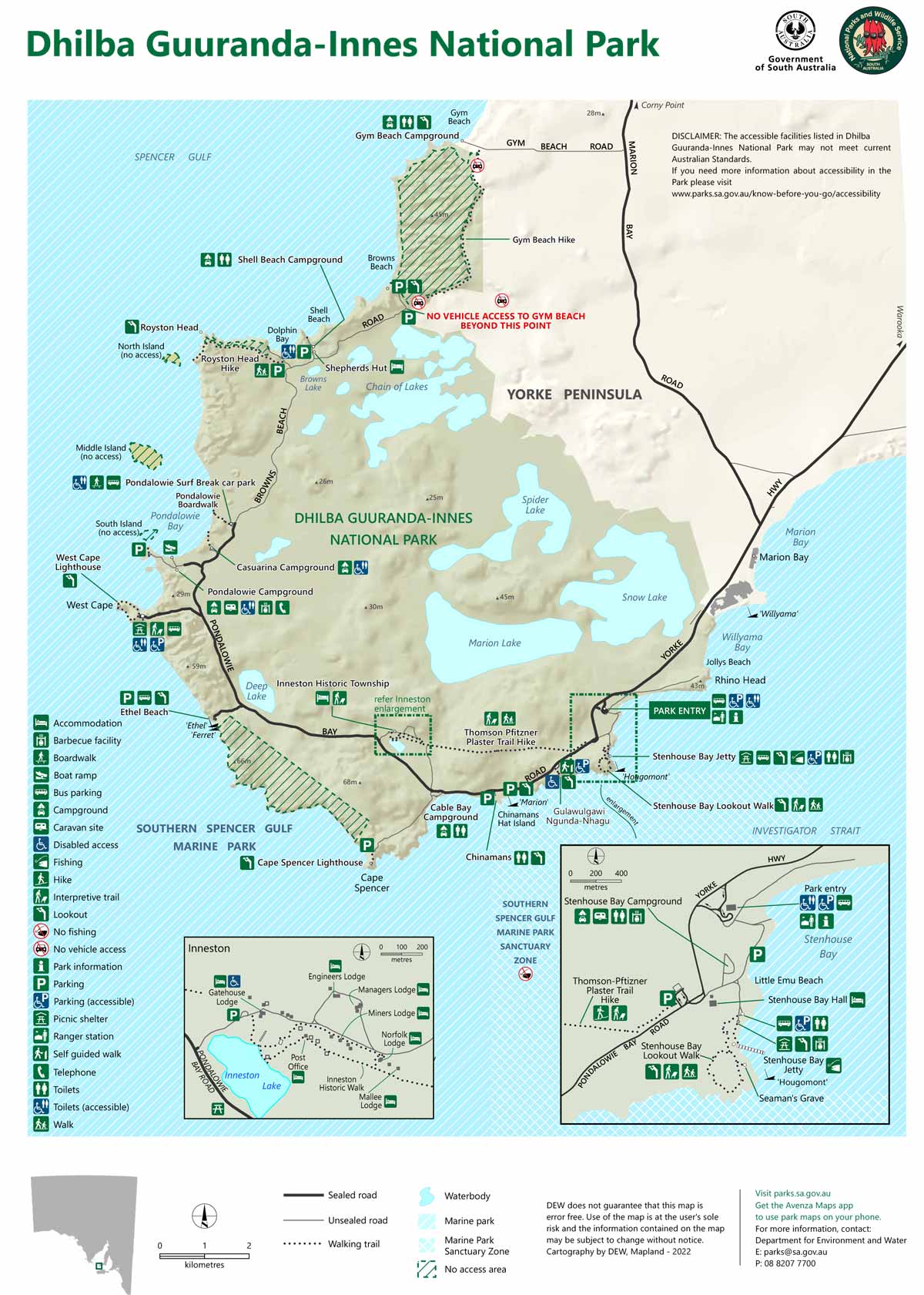
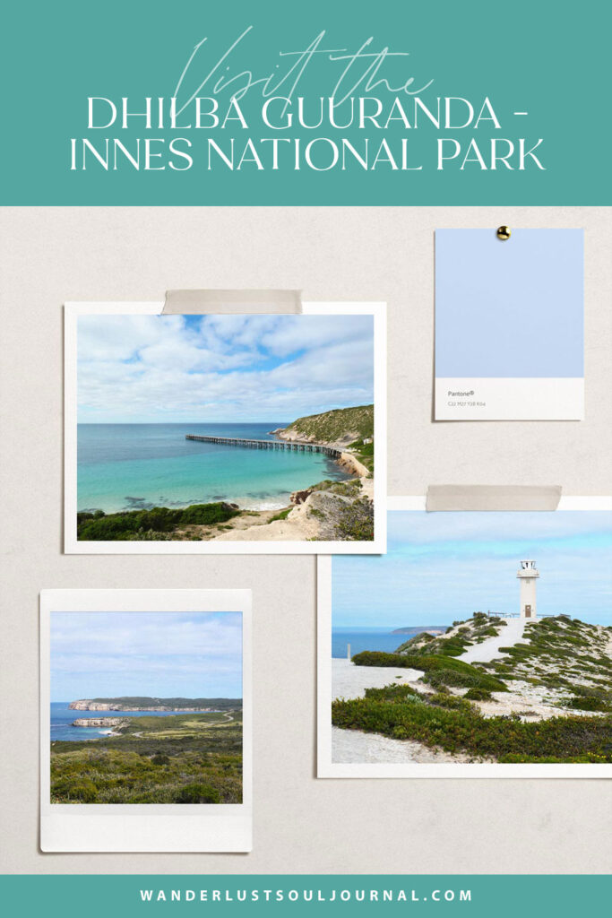
Lower Yorke Peninsula, Part Two: Dhilba Guuranda – Innes National Park
Hey there, friend!
Before delving into today’s journal entry, you might be interested in reading these three journal entries first, if you haven’t already:
Explore the Dhilba Guuranda – Innes National Park with me
An attraction that’s considered one of the top things to do while in the Yorke Peninsula, South Australia, is to visit the beautiful Dhilba Guuranda – Innes National Park.
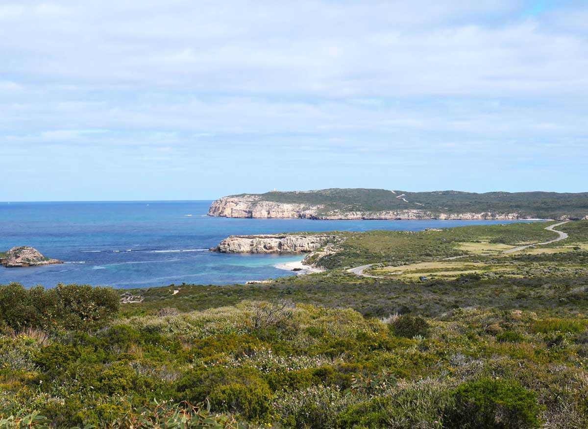
Nestled in the southernmost region of the peninsula, it boasts a coastline of majestic cliffs, epic headlands, and gorgeous bays.
My hubby and I decided to dedicate two full days to venture into this amazing park and explore its scenic landscape. Not going to lie, it felt kind of jam-packed, but we had an incredible time!
Are you travelling to the Yorke Peninsula with your dog?
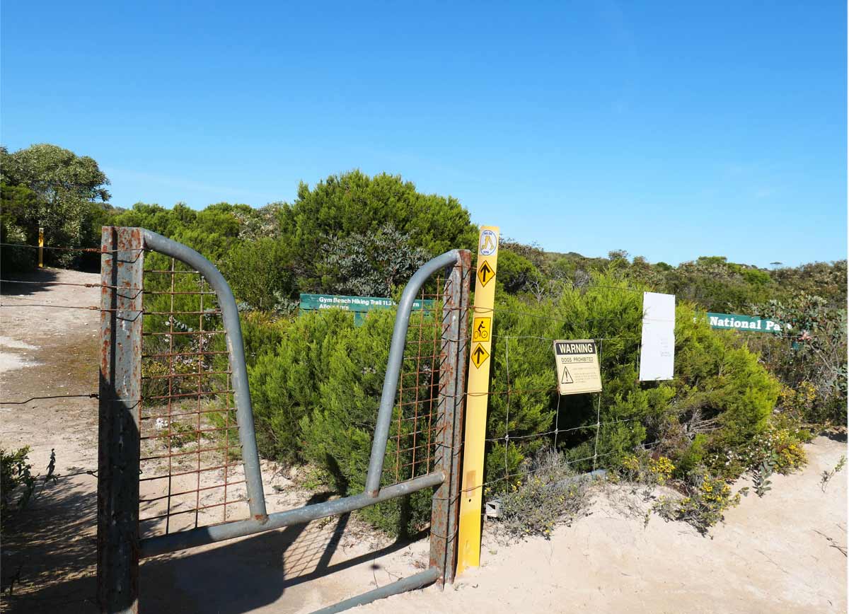
If you are, you’re probably already aware that pets are not permitted into national parks. It’s one of the rare places in the Yorke that isn’t dog-friendly.
But don’t worry, I’ve got you covered my friend! You don’t have to miss out on this gorgeous national park if it’s on your bucket list.
If this happens to be your first time diving into my journal entries, let me mention that we live in our caravan and travel slowly with our sweet furkid, Charlie, in tow.
For the most part, everywhere we’ve visited has been welcoming of dogs but occasionally there’s certain destinations, like national parks, that need a bit more research and planning.
Doggy Daycare and Boarding in Marion Bay
Through some digging around, I found a brilliant doggy daycare and boarding service based in Marion Bay, a small township that’s only about 10 minutes away from the national park!
While we were out sightseeing and hiking, Charlie was having a fantastic time running around with new furry pals. If you’re curious about the details, check out my earlier journal entry, Part One of the Lower Yorke Peninsula.
Okay, now that’s out of the way, let’s jump into visiting the Dhilba Guuranda – Innes National Park!

The history of the park
Prior to European settlement, the land was inhabited by the Narungga people which consisted of four different clans. You’ll see various interpretive signs throughout the park with information regarding the traditional custodians of the land and their cultural significance.
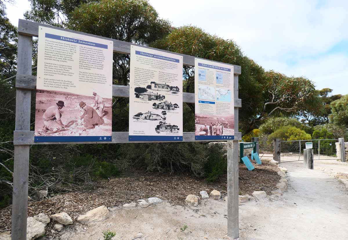
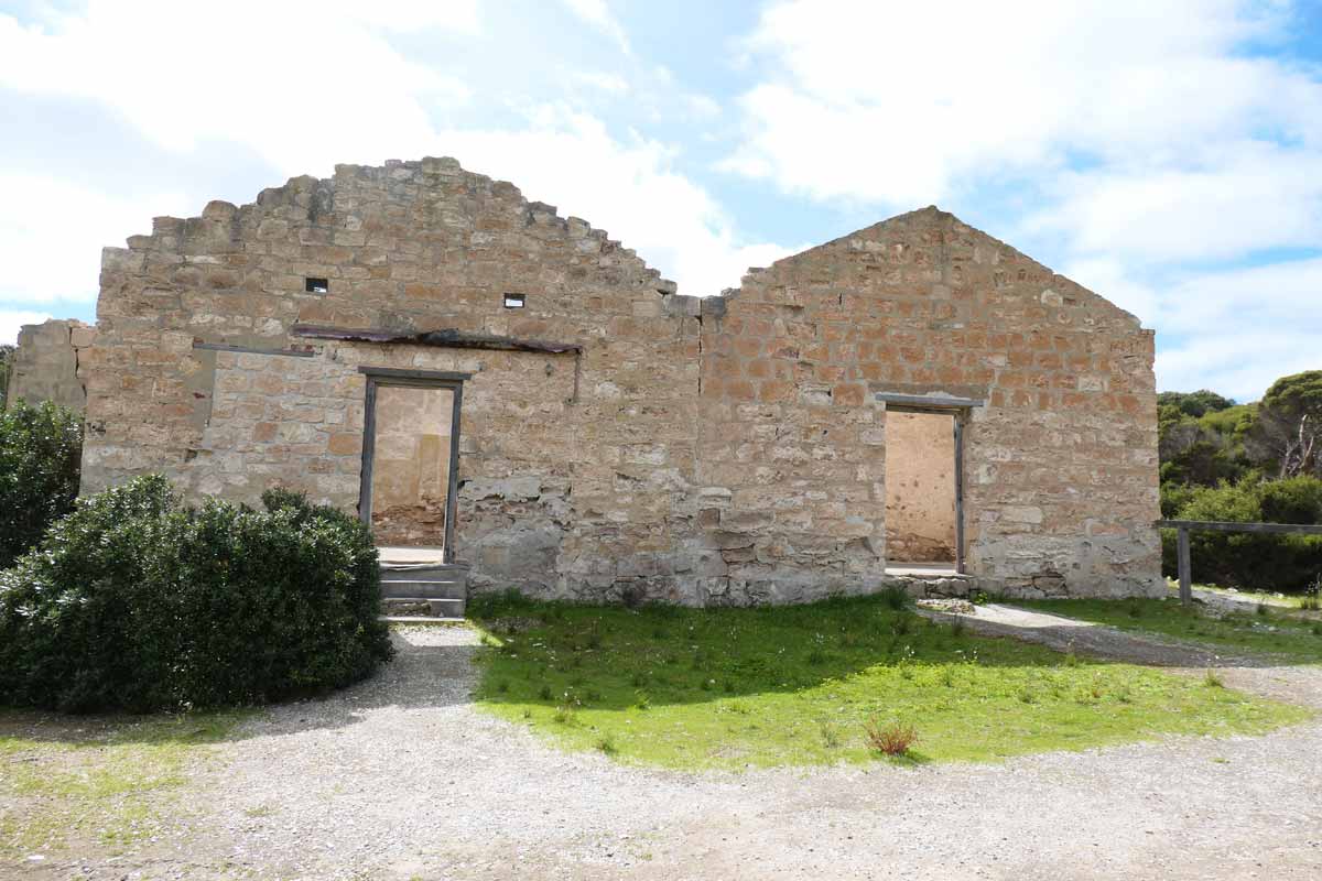
One of the locations you can visit within the national park is the abandoned township of Inneston, which gives you a glimpse into the area’s history.
This small community was established in the early 1900s when gypsum mining began in the area. By the 1930s, the mine was eventually relocated to Stenhouse Bay, where a lot of the facilities from Inneston were also transferred to.
At Inneston, you’ll find remnants of old commercial buildings and homes of the original township. At Stenhouse Bay, you can view weathered historic construction used to transport gypsum to the jetty.
During the early 1970s, the Waratah Gypsum Company closed its doors and Stenhouse Bay along with surrounding land was sold to the South Australian government.
The national park was created to preserve the natural environment and existing heritage structures of the area, as well as providing a recreational space for locals and tourists to enjoy.
Fun things to do at Dhilba Guuranda – Innes National Park
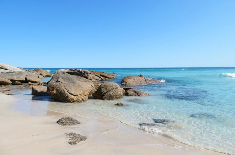
- Swim and chill at one of the many beautiful beaches
- Visit the lighthouses and shipwrecks
- Admire the rugged cliffs and ocean views along the coastline
- Explore the abandoned town of Inneston
- Go beach or jetty fishing
- Take a bushwalk along one of the many trails
- Surf the waves
- Go scuba diving
- Stay overnight at one of the campsites or lodges
- Enjoy a sunrise or sunset overlooking the ocean
- Spot wildlife – emus, kangaroos, wallabies, ospreys, dolphins and more!
How to get there
Driving
The best way to get to the national park is by driving, and surprisingly, it’s not that far from Adelaide! It’s just over a 3 hour drive, taking the Yorke Highway pretty much the whole way. The end of Yorke Highway is the entrance of the national park.
Previous to the Yorke Peninsula, we had spent a month staying in the Barossa Valley wine region. One thing I noticed about driving the length of the Yorke Peninsula is how flat the terrain is in comparison.
Barossa had these huge rolling hills which were amazing to look at, but not great for towing the caravan.
There was a particularly long stretch of hilly, windy road that we went through and the car started making funny clunking noises afterwards. We had to pull over to let our poor Prado cool down for a bit. The noise disappeared thankfully.
That’s not a problem you’ll come across driving through the Yorke Peninsula because it’s fairly flat and easy. If you’re travelling in September, like we did, you probably won’t find it busy on the roads at all.
Walk the Yorke
I don’t know if it’s a realistic option but if you’re a keen hiker/cyclist and you had the time, you could also make your way down via Walk the Yorke.
This is a collection of trails that join together to follow the coastline of the peninsula from Port Wakefield to Moonta Bay, a whopping 500 kilometres! There are trails within the national park that are part of Walk the Yorke, we did a section of it, but more on that later.
While we were at the Marion Bay Tavern, we actually met a couple of older gentlemen on their way to doing a 4 day trek – Marion Bay to Corny Point, going through the national park. Of course, you have to fuel yourself up before a long hike, and what better way than with a pint of beer and a chicken parmi!
Vehicle Entry Fee
Single Entry Pass
There is a vehicle entry fee of $13 per vehicle to enter the national park for the day.
Purchasing online
The easiest way to purchase a pass is via the SA National Parks and Wildlife Service website.
During the process, you enter your car registration number so there’s no printout required or need to display anything on your dashboard while you’re there. A confirmation email gets sent out for your records.
Visitor Information Centre
There’s a visitor information centre inside the Dhilba Guuranda – Innes National Park, near the entrance. You can purchase a pass from here, grab maps and guides, or speak to park staff for tips and advice. Opening hours are between 10am – 3pm, daily.
You can also pop into any visitor information centre along your journey, click here to view the various locations.
Multiple Entry Pass option
There’s also options to purchase a vehicle entry pass that allows you to visit either a single park or multiple parks, as many times as you like, within either a 2 month or 12 month period.
This means that you don’t need to keep purchasing an individual pass for every single day that you want to enter a park. It makes things easier, plus it might be the more cost effective solution, depending on how many days you go.
This is something to consider if you’re wanting to take your time and enter one park several times or maybe you’re planning on visiting several other parks within South Australia during your travels.
Other national parks in South Australia you could visit
- Belair National Park
- Coffin Bay National Park
- Deep Creek National Park
- Ikara-Flinders Ranges National Park
- Gawler Ranges National Park
- Lincoln National Park (including Memory Cove Wilderness Protection Area)
- Mount Remarkable National Park
- Ngarkat Conservation Park
- Para Wirra Conservation Park.
Vehicle Entry Fee waived
If you’re planning on staying within the park and have paid the campsite or lodge fee, you don’t need to worry about purchasing vehicle entry. The campsite or lodge fee already includes vehicle entry. Also, depending on where you’re staying, this can mean vehicle entry for multiple cars.
Walking/Cycling
Since you’re not driving a vehicle into the national park, you don’t need to buy a pass!
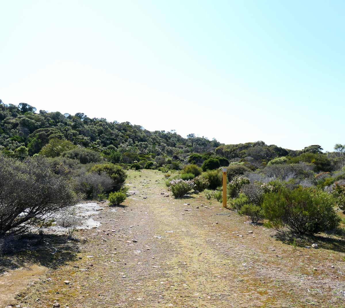
Road quality & navigating through the park
The national park is relatively small, consisting of 92 square kilometres. All of the roads are accessible by 2WD – most of the roads are sealed but there are sections of road towards Shell Beach, Dolphin and Browns Beach that are unsealed.
These are well graded though and you should be fine if you take care. The main road in the park is Pondalowie Bay Road, which follows the coastline in a semi-circle, and has exits of varying distances for the different sights.
You can download PDFs of the national park maps through the SA National Parks and Wildlife Service website. You can find a general map plus specific ones for the different campgrounds, Inneston township and walking trails.
I don’t know much about it but you can download and use the Avenza Map app for navigation. Google Maps also has most of the sights and walking trails marked, you could download a copy of the area to use offline.
Or, pick up a brochure/map through a Visitor Information Centre within the peninsula.
Accommodation within the park: Campgrounds and Lodges
If you want to make the most of your national park experience – maybe watch the sun set over the ocean or get up super early to watch it rise, you could stay at the grounds overnight or multiple nights.
There are a number of campgrounds and lodges available within the park, you can book these through the SA National Parks and Wildlife Service website.
Camping fees are from $25/night and most, if not all, are unpowered sites. All campgrounds have long-drop toilets.
It’s best to check the SA National Parks and Wildlife Service website for details on each campground. They supply information on suitability, location and what’s nearby, number of sites etc.
List of campgrounds available
- Cable Bay Beach
- Casuarina
- Gym Beach
- Pondalowie Bay
- Pondalowie Caravan and Trailers
- Shell Beach
- Stenhouse Bay (also marked suitable for caravans on their map).
Within the historic township of Inneston, there are quite a variety of buildings that have been repurposed for short stay accommodation. Prices start from $122/night for Post Office Lodge to $183/night for Engineers Lodge, these are all furnished and equipped.
It’s best to check the SA National Parks and Wildlife Service website for details on each lodge. They supply information on size, suitability, number of rooms, style, features and facilities etc.
List of lodges available
- Engineers Lodge
- Gatehouse Lodge
- Mallee Lodge
- Managers Lodge
- Norfolk Lodge
- Post Office Lodge
Shepherds Hut is a heritage building located near the Shell Beach Campground, north west of the park. This is a simple hut with just one room consisting of bedding, tables and chairs and a wood-fired stove. There’s no electricity, no toilet etc.
Alternative accommodation outside of the Dhilba Guuranda – Innes National Park
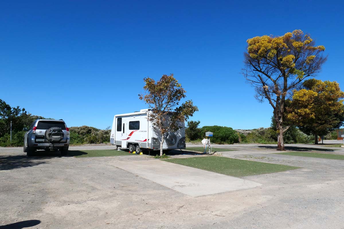
The closest town to the national park is the small and quiet Marion Bay, about 10 minutes away. We stayed at the local caravan park there, which you can read more about if you click here.
However, walking around the area, we noticed Marion Bay Motel (next to the tavern), Marion Bay Holiday Villas, and quite a number of small to large holiday houses available for rent.
What time of year is best to visit
You know, it really depends on why you’re visiting!
If you’re wanting to spend most of your time hitting the beaches for a swim or a snorkel, you would probably want to go in the summer months, when the weather is beautiful.
However, bear in mind that this will be the busiest time of year and there will be a lot more people (school holidays and Christmas/NY break from work). If you’re planning on camping or lodging, you’ll want to book these in advance.
If you don’t like crowds, March might be a good month to go because the weather should still be good, however, everyone would be back to their regular routine.
Autumn and spring months are best for hiking because of the cooler weather, even during the middle of the day. In spring, you’ll see a lot more of the wildflowers come out.
The winter months can be quite beautiful in the park because everything is lush and green, it’s less busy, and the wild seas can be epic to watch. On the downside, you’re going to encounter wild winds and rain.
We went during the beginning of spring, early September, and it was quite cool still. The first day was cloudy and super windy but the second day was sunny and fine.
National Park Opening Hours
The national park is open daily, 24 hours. Just make sure you’ve paid your vehicle entry fee or camping/lodging fee before you go into the park, you’ll spot a big sign at the entrance to remind you!
The Visitor Information Centre is open between 10am – 3pm, daily.
Facilities within Dhilba Guuranda – Innes National Park
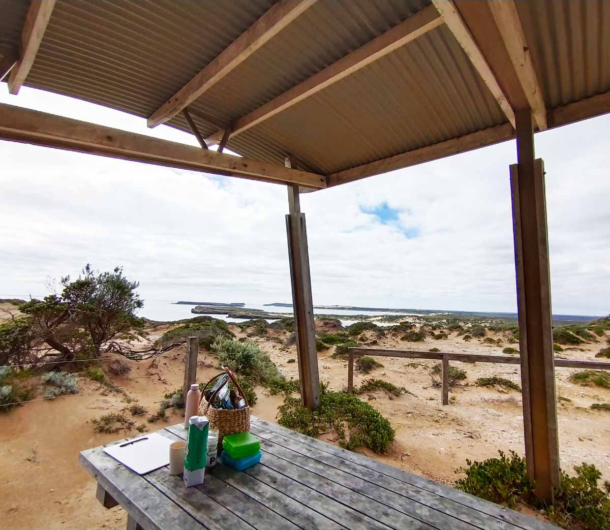
Picnic shelters
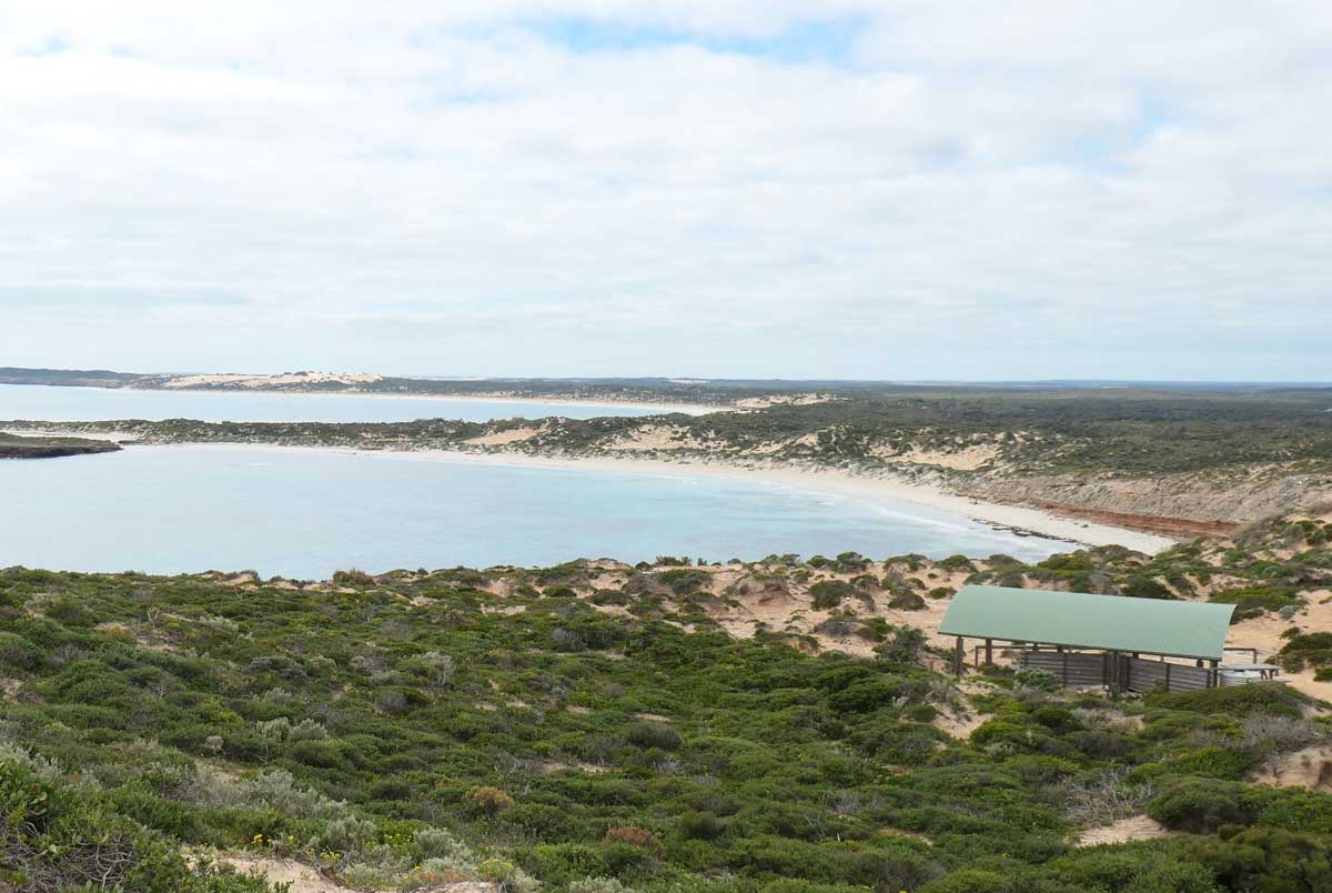
If you’re at the park for the day, there’s picnic shelters at Stenhouse Bay and West Cape. On one of our days, we stopped at West Cape to have our lunch.
We were munching away on our salami, cheese and salad wraps when a family came and set up their lunch at the picnic benches near us. They had bought an electric cooker and the smell of marinated meats being grilled was soooo good!
BBQs
There are also BBQs available for use at Stenhouse Bay and the Pondalowie Campground; you can view all of the national park facilities on their map, marked out by icons.
Toilets
The park provides long-drop toilets at all campgrounds, near picnic shelters and there’s some at certain car parks. Some toilets are nicer than others – the one at Chinamans car park is rustic and I would avoid it, while the one at the carpark for Shell Beach was much more modern and clean.
Rundown of the sights and attractions
These are in the order as you would pass them on the map.
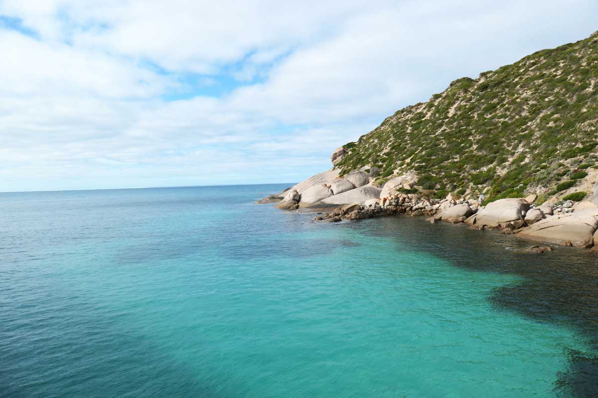
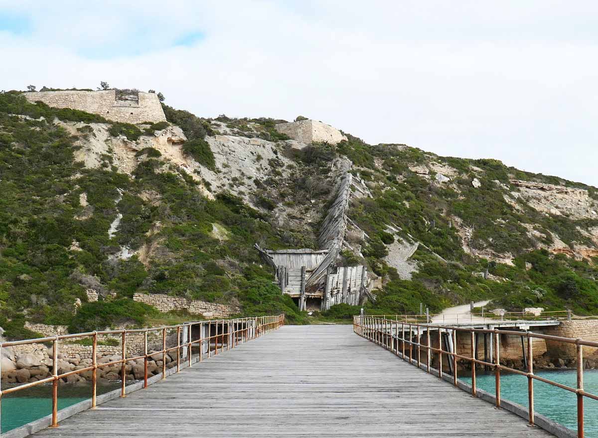
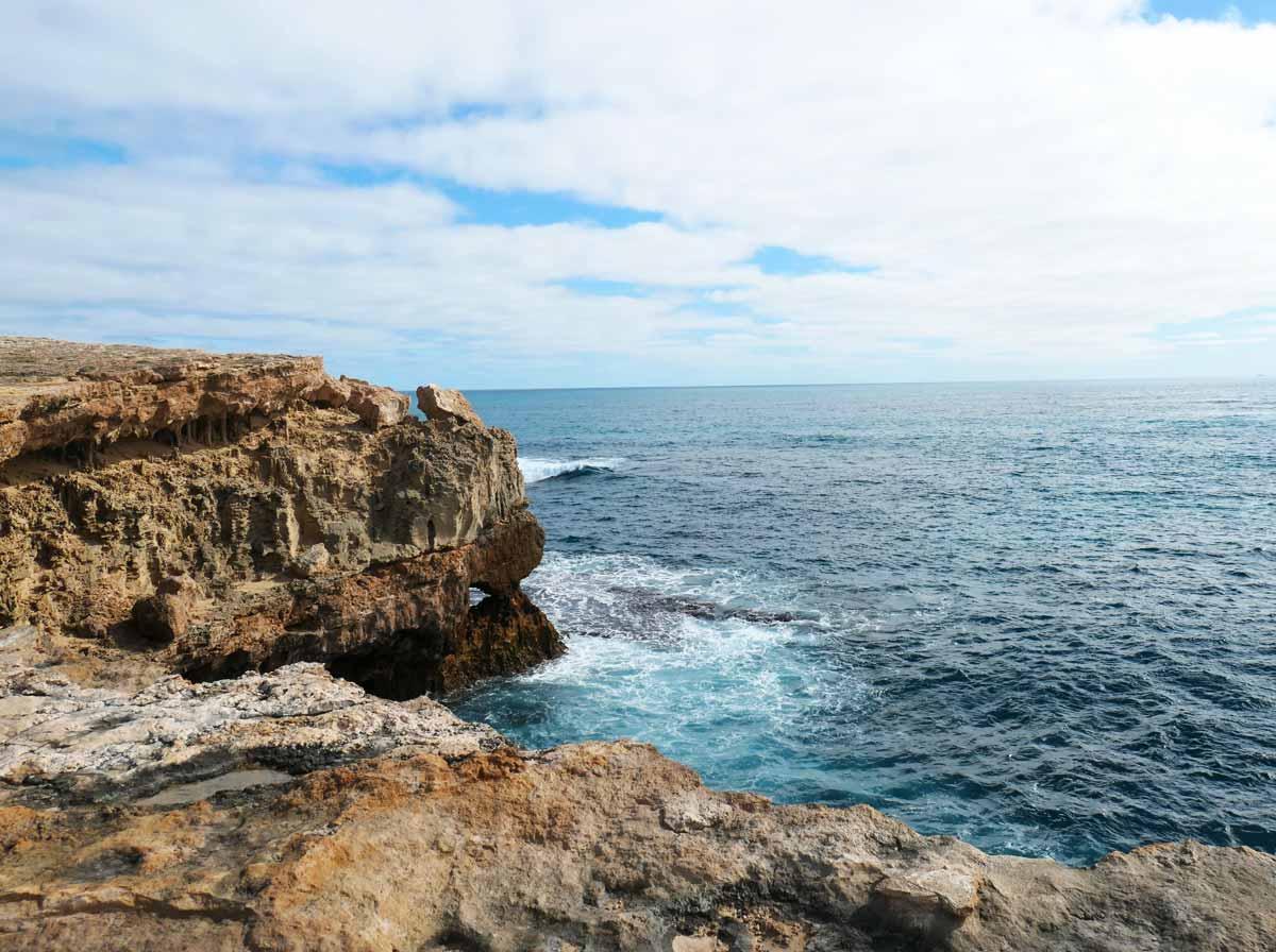
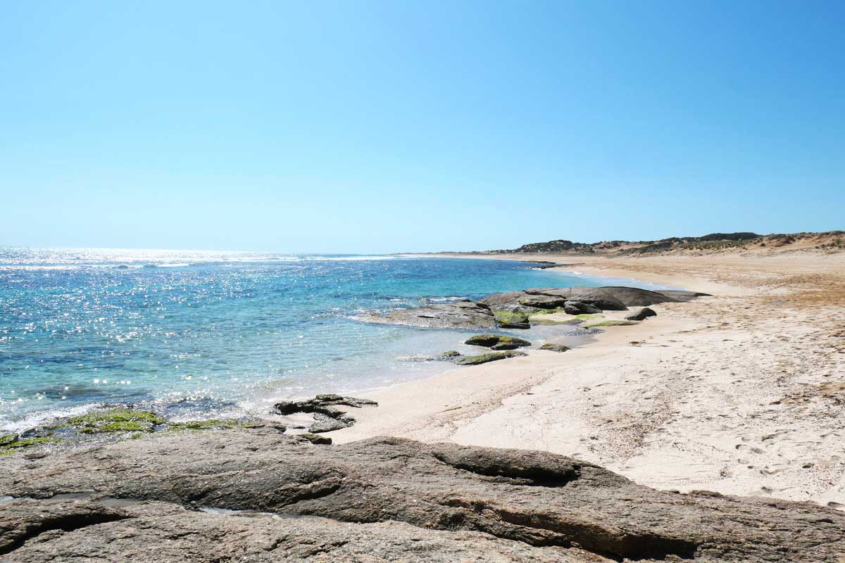
Stenhouse Bay Jetty *
This was probably one of my favourites because the bay was so picturesque, the colours of the water was just stunning. It was also cool to see the old gypsum mining structures embedded on the side of the cliff.
From the carpark, there’s a short, slightly steep walk trail that leads towards the jetty. There’s also a large picnic shelter and BBQ facilities near the carpark.

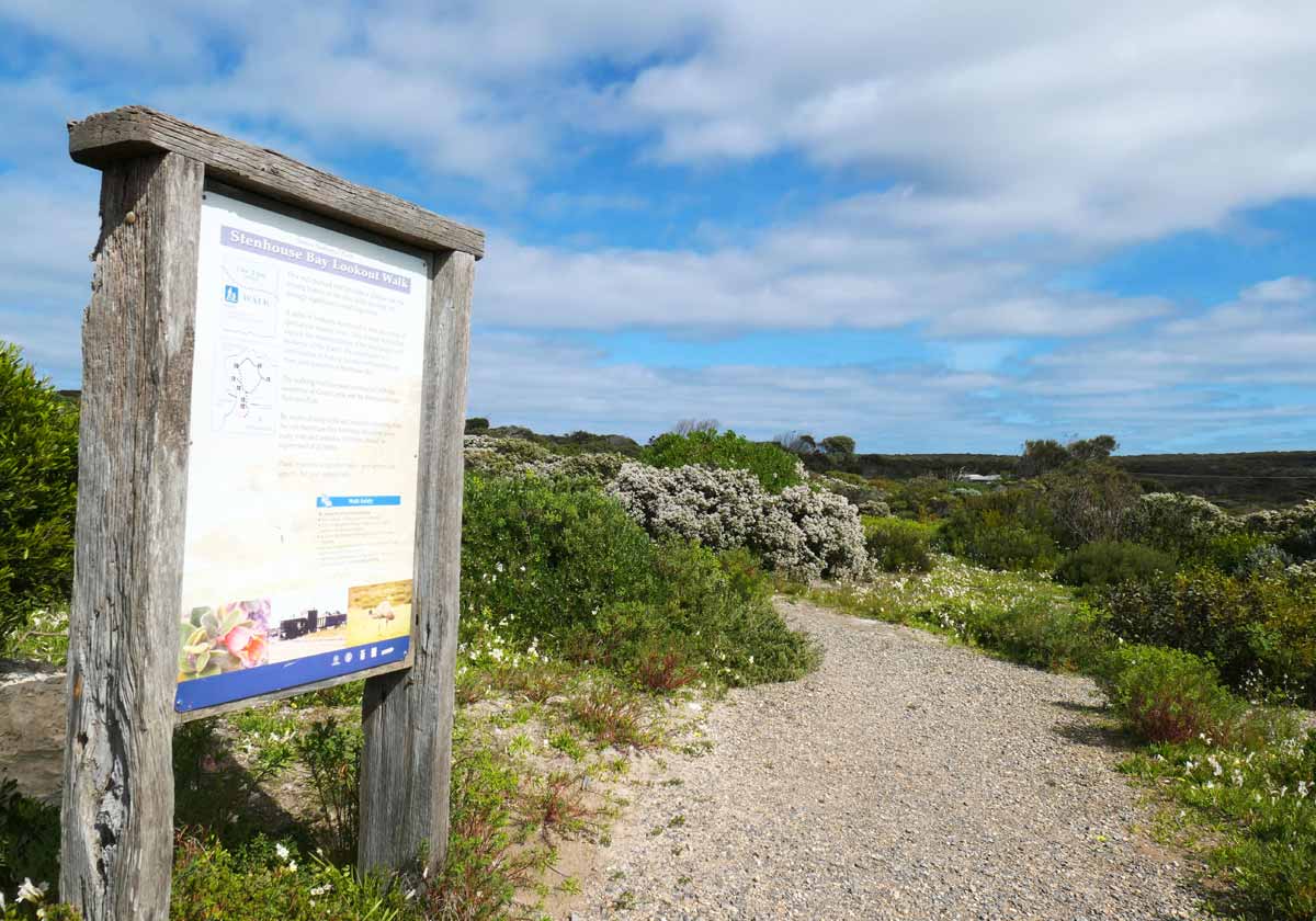
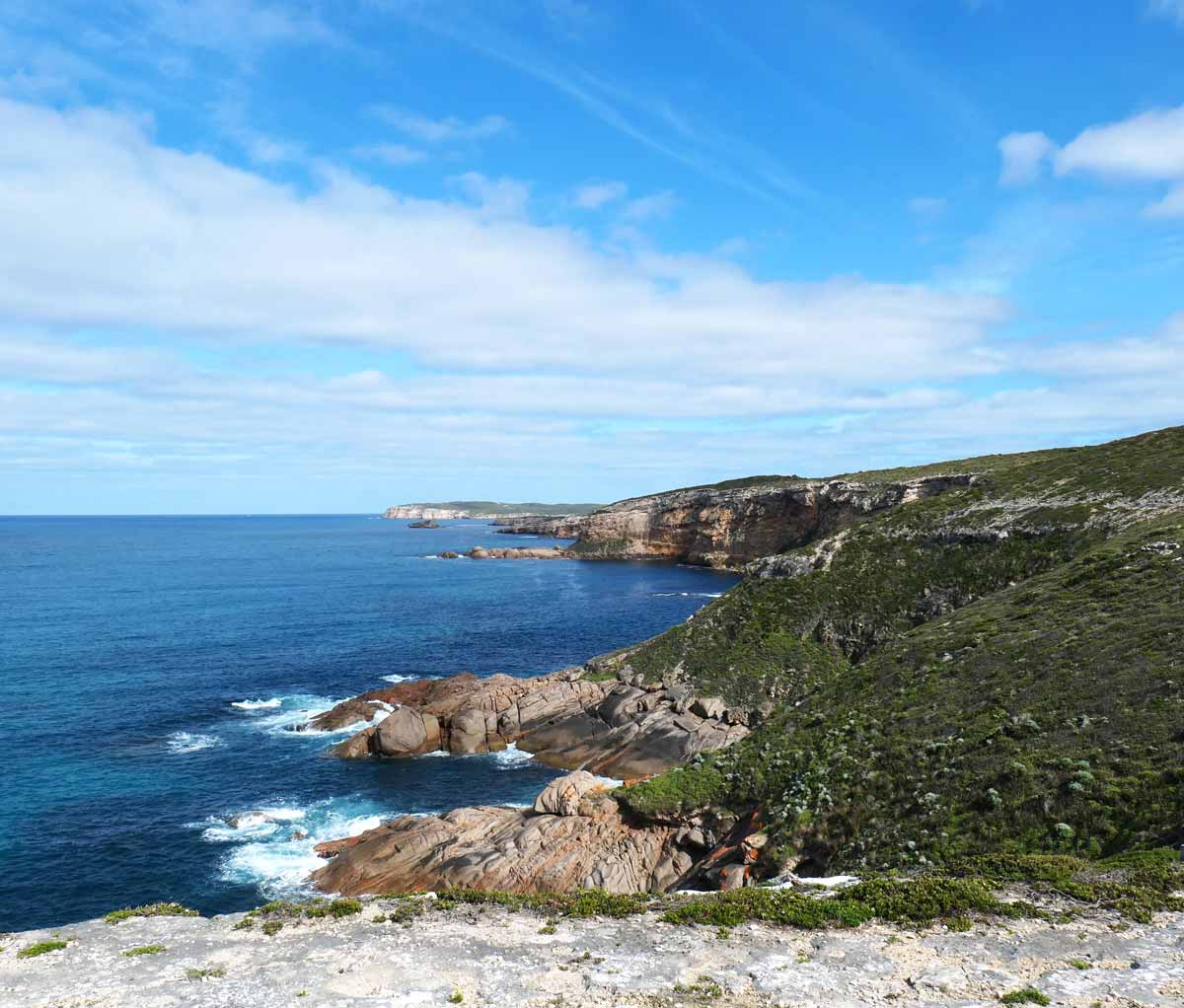
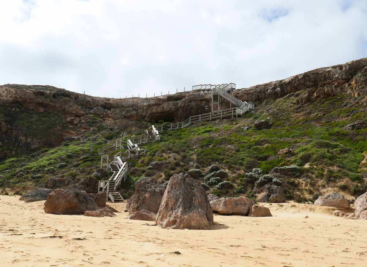
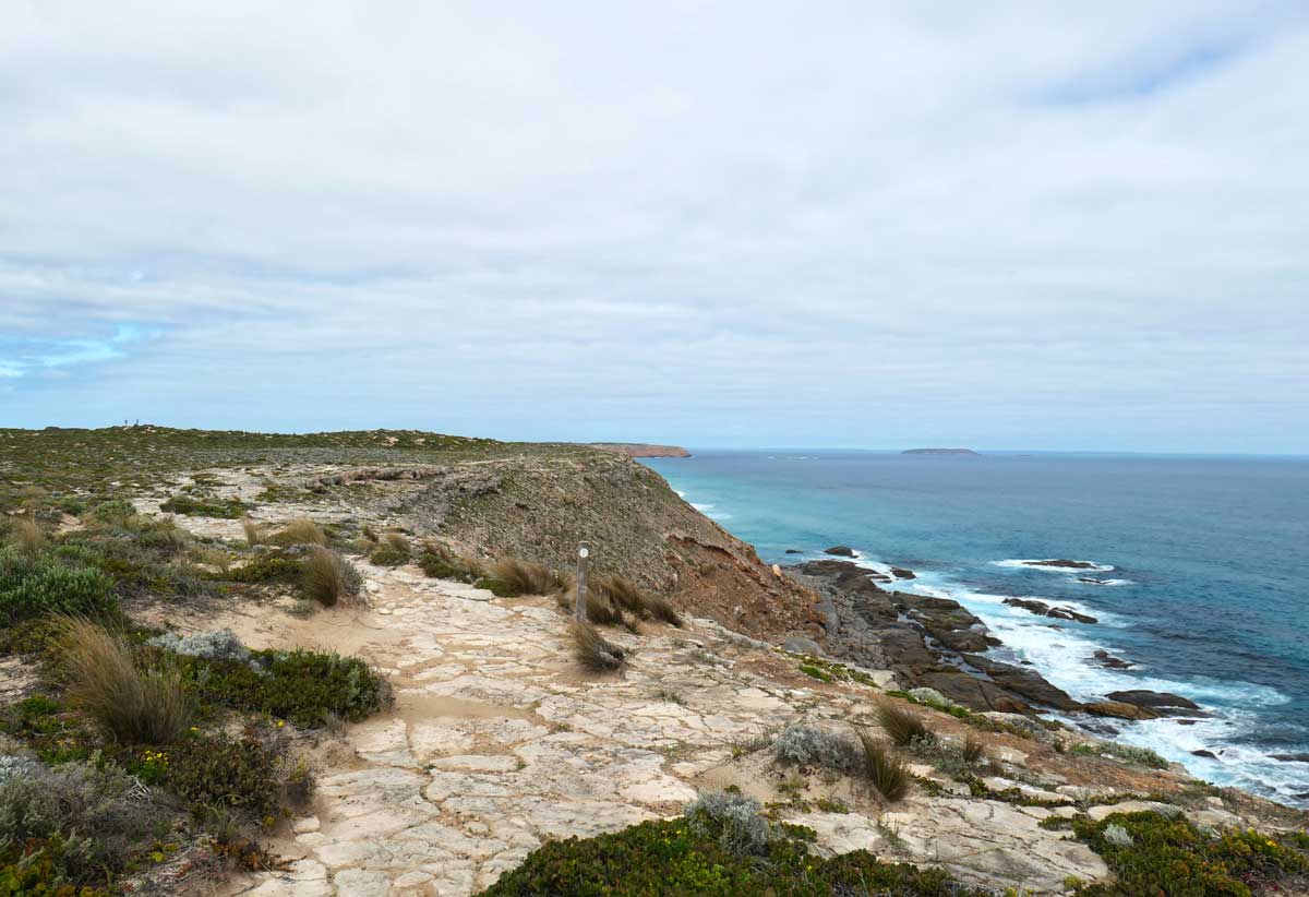
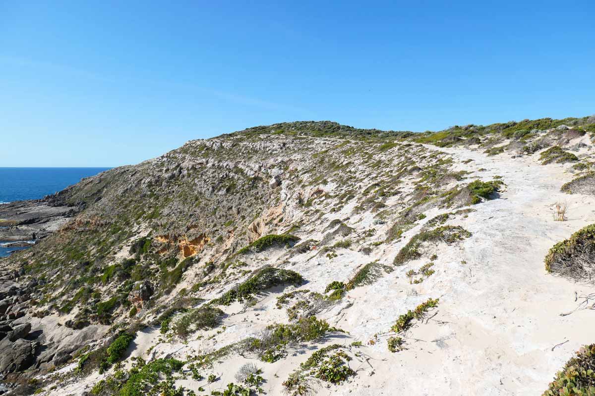
Stenhouse Bay Lookout Walk *
The Stenhouse Bay Lookout Walk is a 2km loop that starts at the top of the cliff near the carpark and goes through shrublands. There are several viewing points – I especially liked the section of trail that followed the cliff’s edge and treated you to a spectacular view of the ocean and jagged coastline.
It’s also memorable because a couple of minutes into it, I got stung by a persistent little bee! I can’t remember the last time I’d been stung by a bee but it hurt and itched for a long time.
Before we left, I had put peppermint oil around my neck and ears because I was feeling stuffy. I think this is why the bee wouldn’t leave me alone during the walk. Learn from me, don’t put peppermint oil on if you don’t want to attract bees!
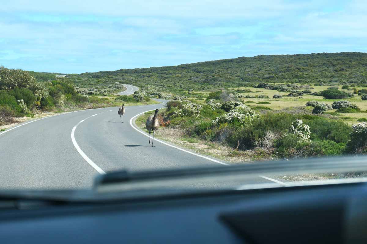
While on our walk, we came across some emus surrounding one of the viewing platforms, so we decided to skip that particular one. Emus kind of freak me out, they have shifty eyes and you just don’t know what direction they’ll go!
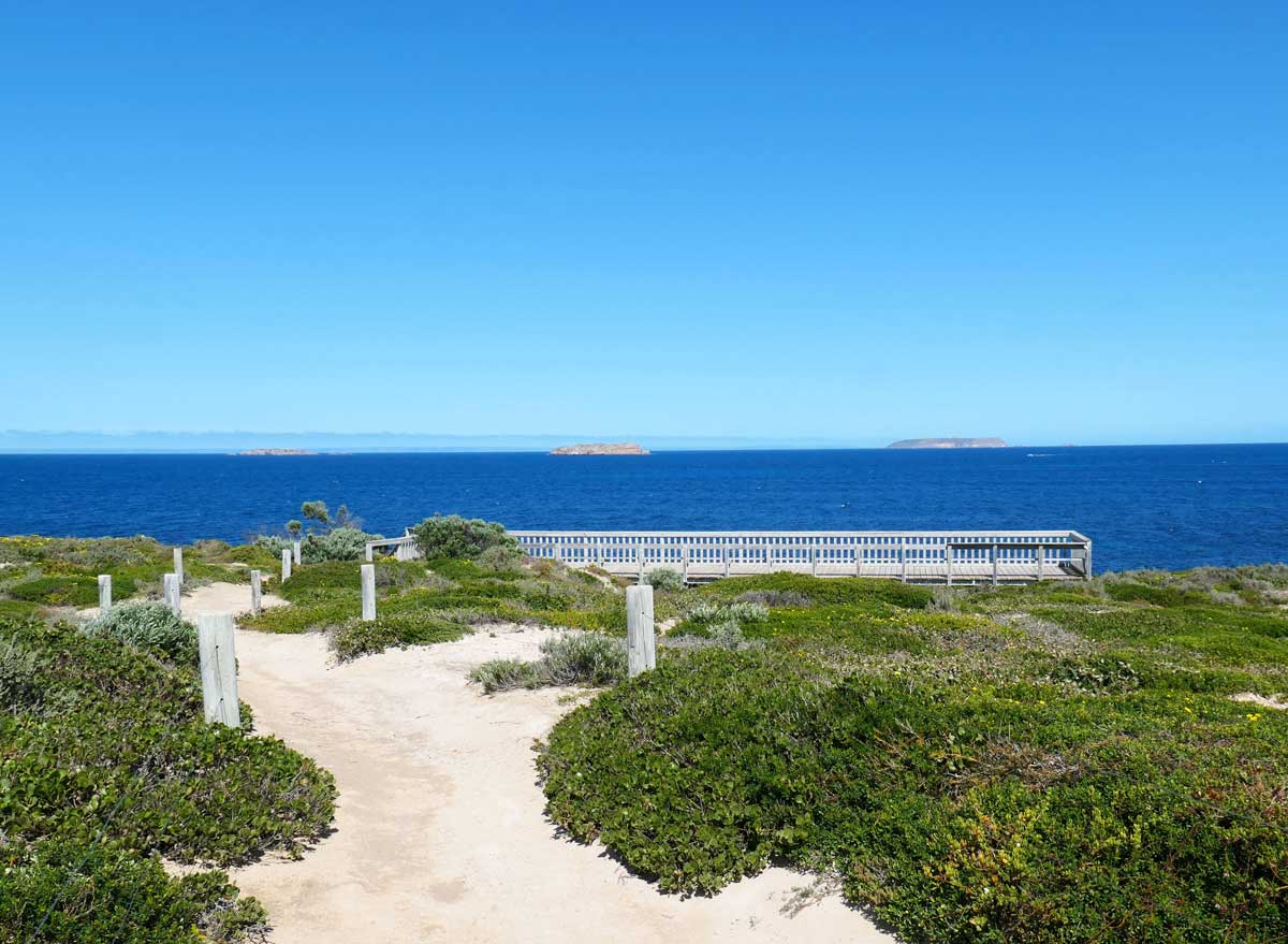
Gulawulgawi Ngunda Nahgu – Cape Spencer Lookout
This elevated area gives you a panoramic view of the national park landscape and it’s a great lookout for Cape Spencer. There’s a short easy walk to get there from the carpark.
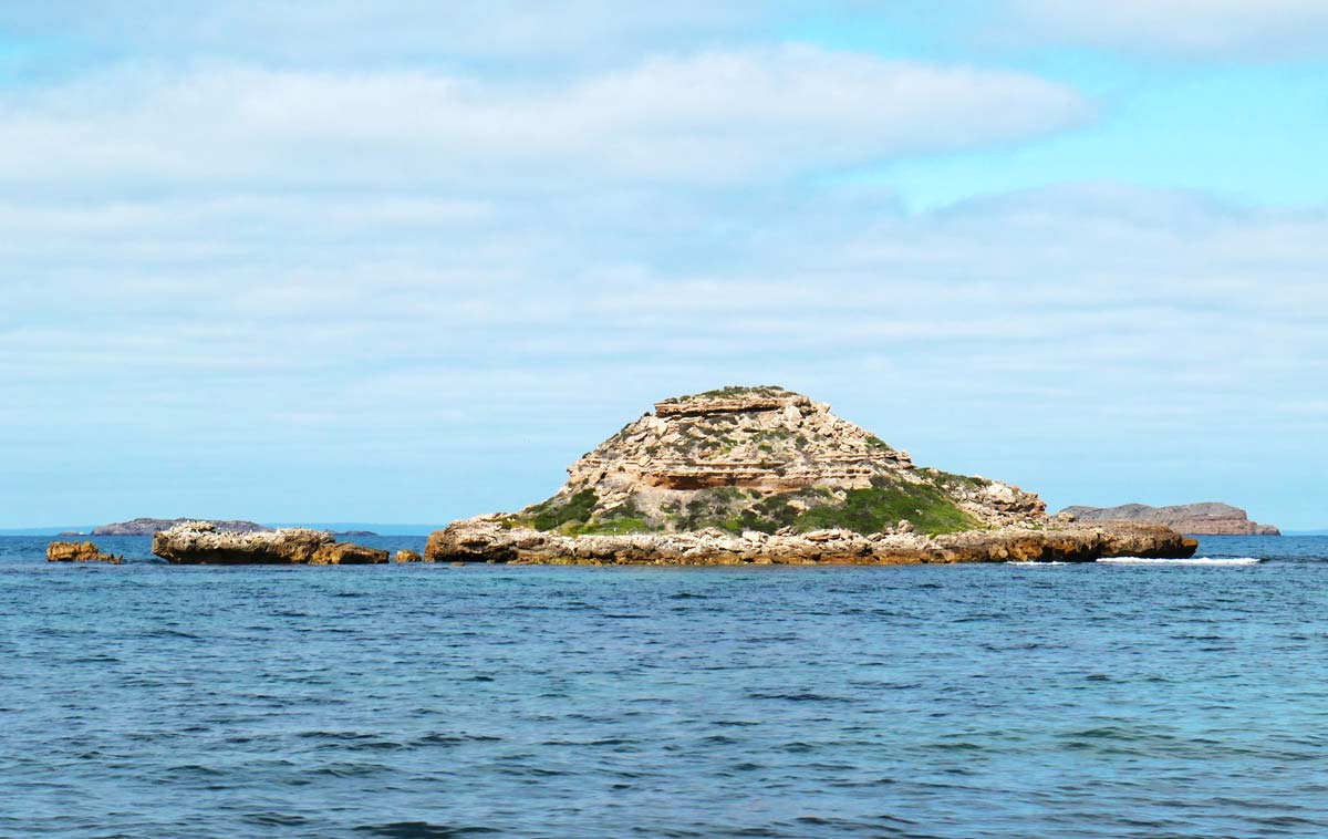
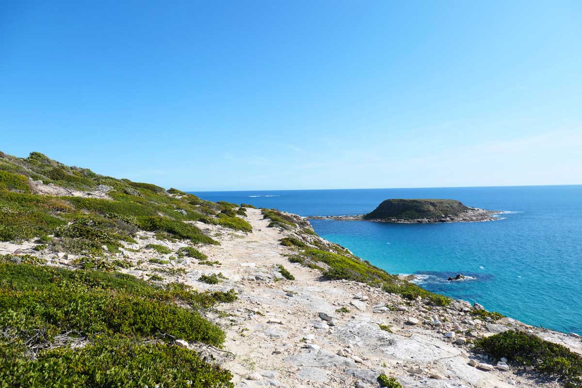
Chinamans Hat (Lookout)
This offered a view of Chinamans Hat, a little island just off the coast. There were stairs that led down to a beach.
Chinamans (Carpark)
This had a large viewing platform with stairs down to the beach, where we found a tiny cove with small rockpools and little shells. The walk from the carpark is much longer and I think from memory, on soft sand. There are toilets here but use them at your own risk – they look rustic!
Inneston Historic Town Walk
This is a looped 2km walk and takes you past Inneston Lake and through the township. It’s kind of interesting to see what’s left of the town and to walk inside the abandoned buildings.
There’s interpretive signage throughout the walk with historical information. It’s amazing how big families would live in such teeny, tiny dwellings!
We didn’t do this, but if you wanted to extend your walk, the Thomson-Pfitzner Plaster Trail runs from the town of Inneston to Stenhouse Bay. It’s a 7.6km return walk and apparently follows the old wooden railway line.
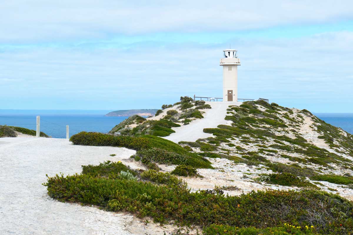
Cape Spencer Lighthouse
This cute little white lighthouse is one of two at the national park. It only has a short walk from the carpark and offers beautiful views of the nearby islands and cliff-lined coast.
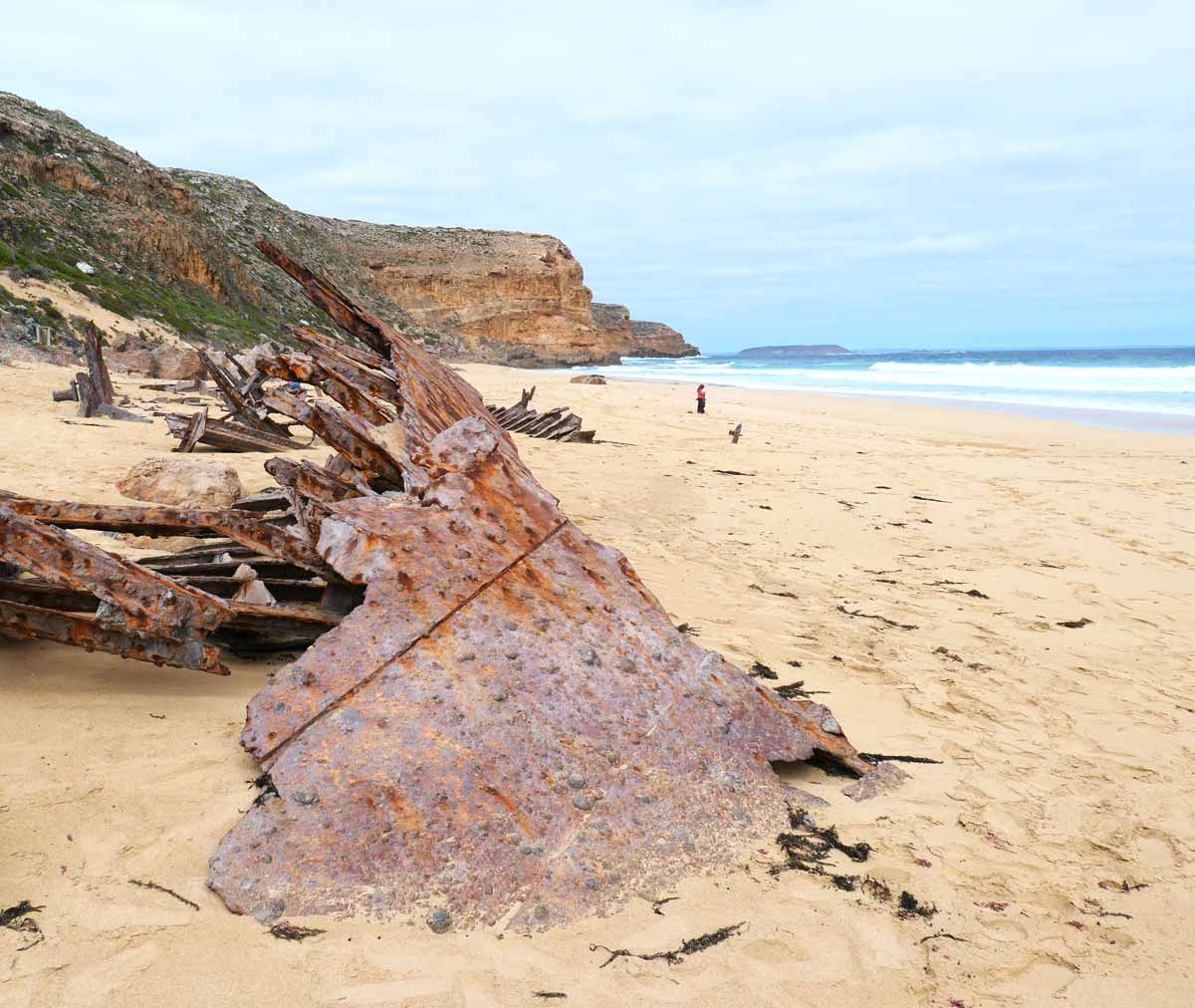
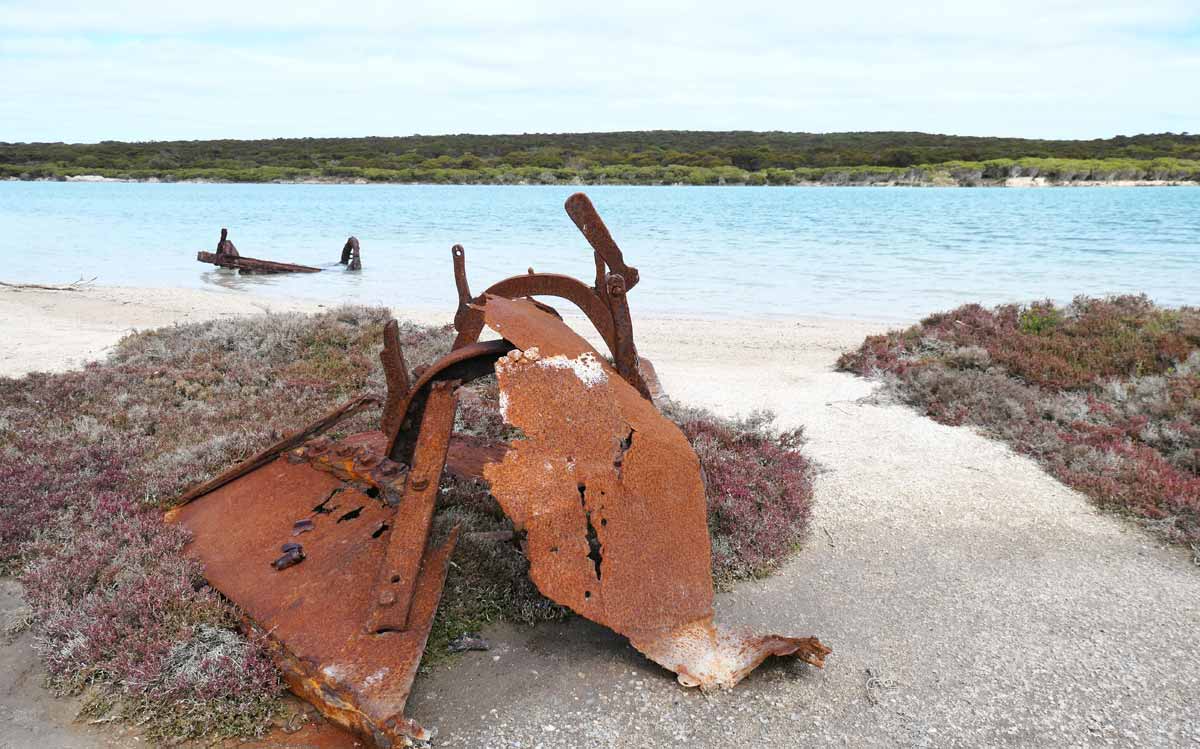
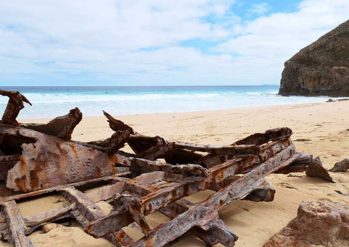
Ethel Beach Wreck
Let me just start with one thing that stood out just as much as the wrecks, the monumental staircase to get down to the beach! Wow, my step count was high that day.
With the strong winds we felt during some of the clifftop walks, it doesn’t surprise me that there are 40 wrecks that lay just off the coastline of the national park.
At Ethel Beach, you can view one of these wrecks which crashed during a severe storm in 1904. Its remains can be seen scattered along the beach.
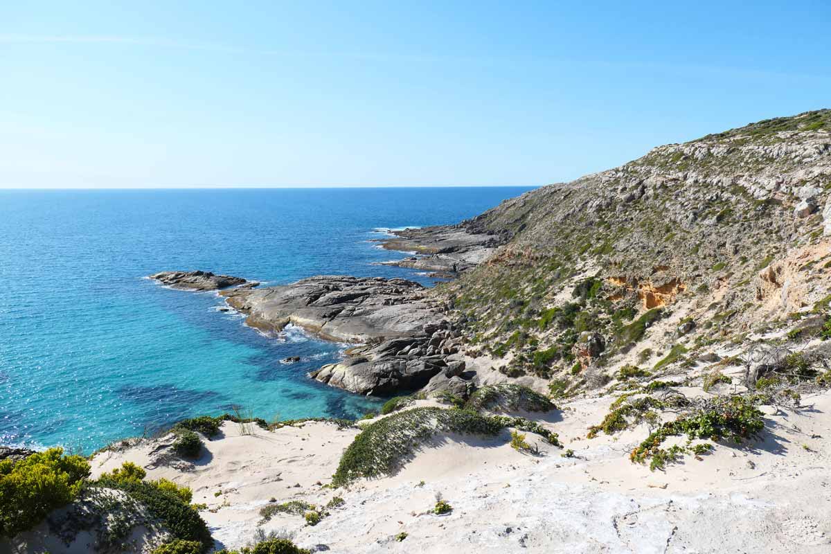
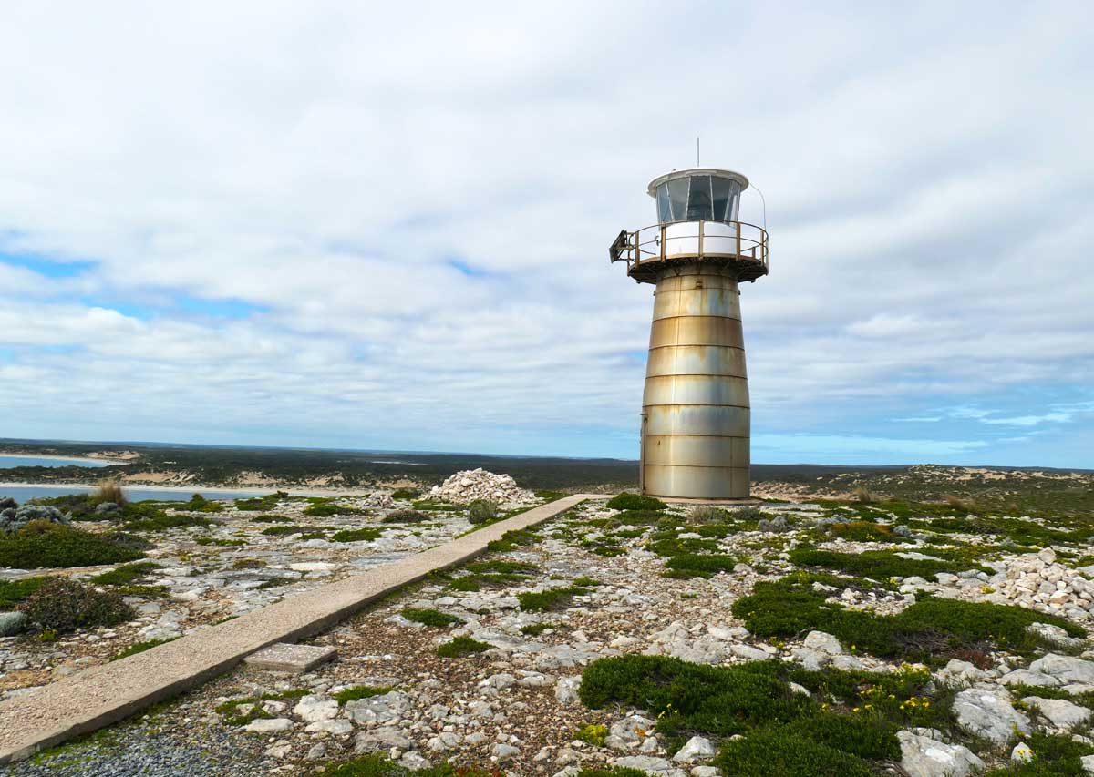
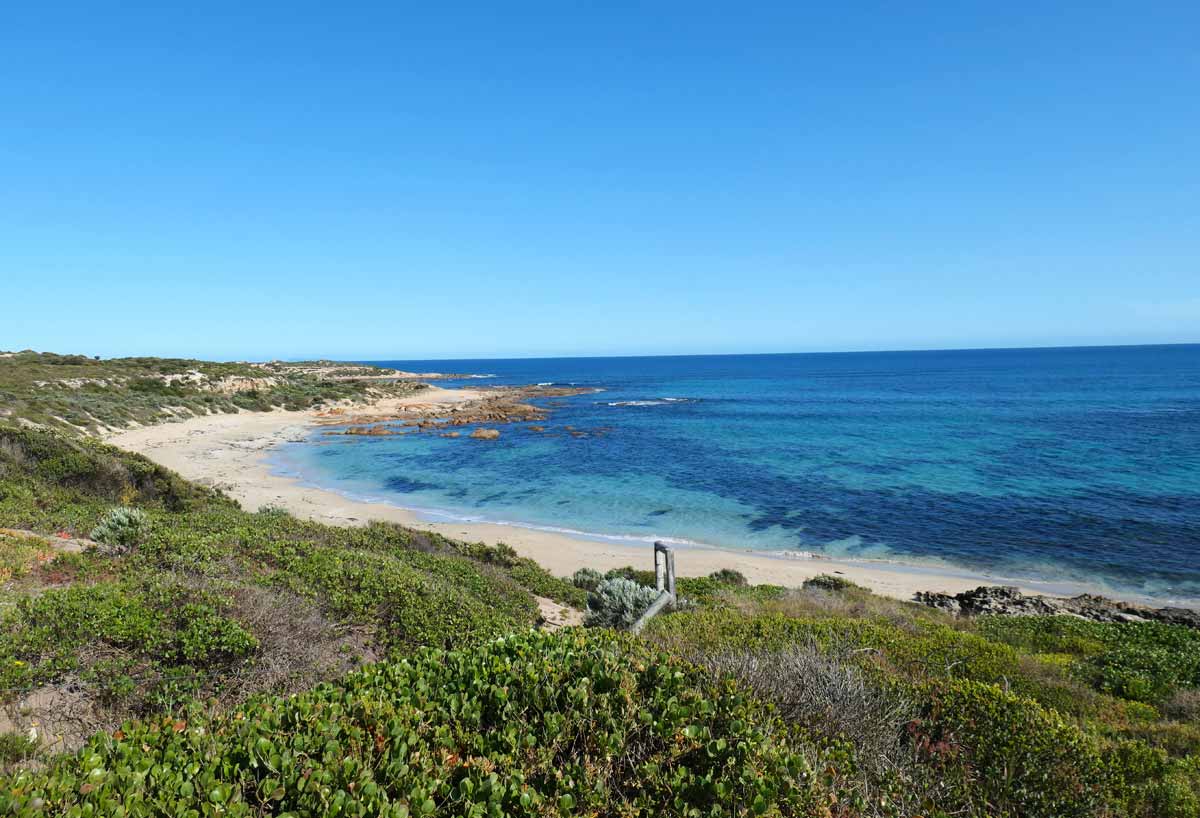
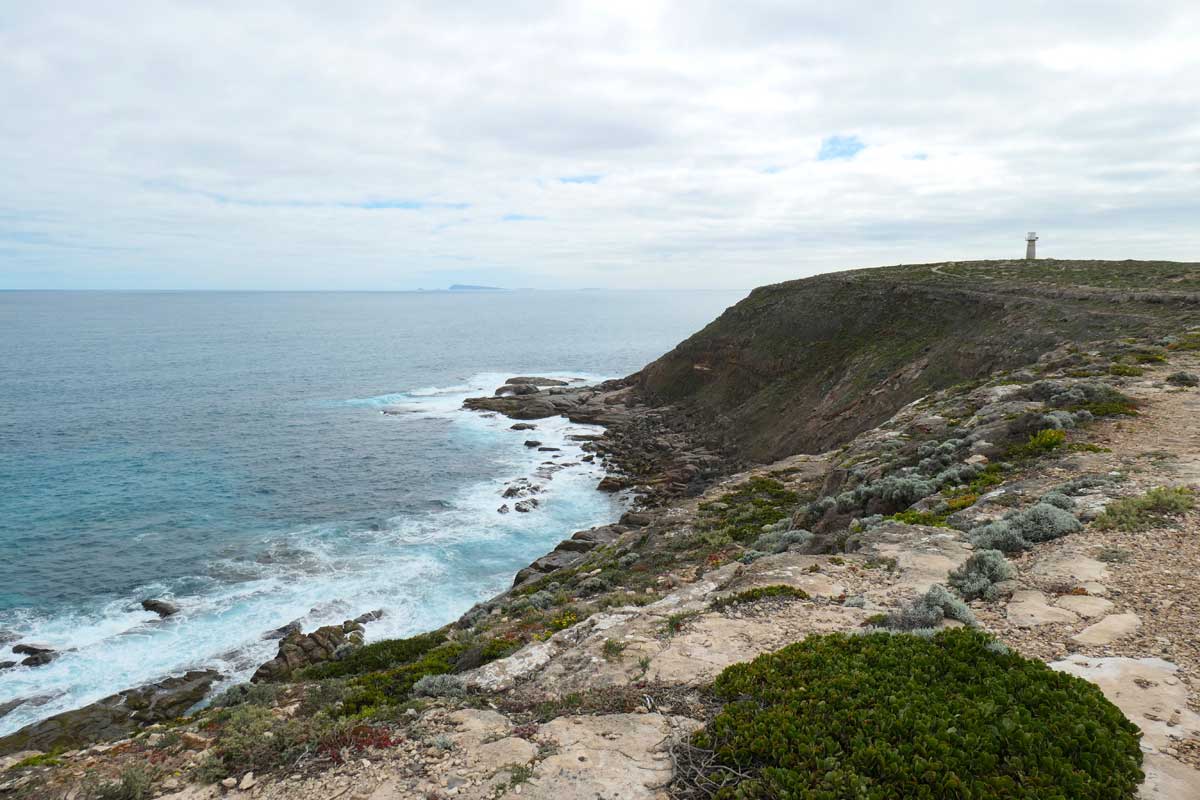
West Cape Lighthouse (Headland Hike) *
To get to the lighthouse, there’s a short 1km loop walk from the carpark. The clifftop trail gets awfully close to the edge and I had anxiety that a huge gust of wind would just blow me right off, it was a very blustery day!
However, the wild winds did make for wild waves which was epic to see.
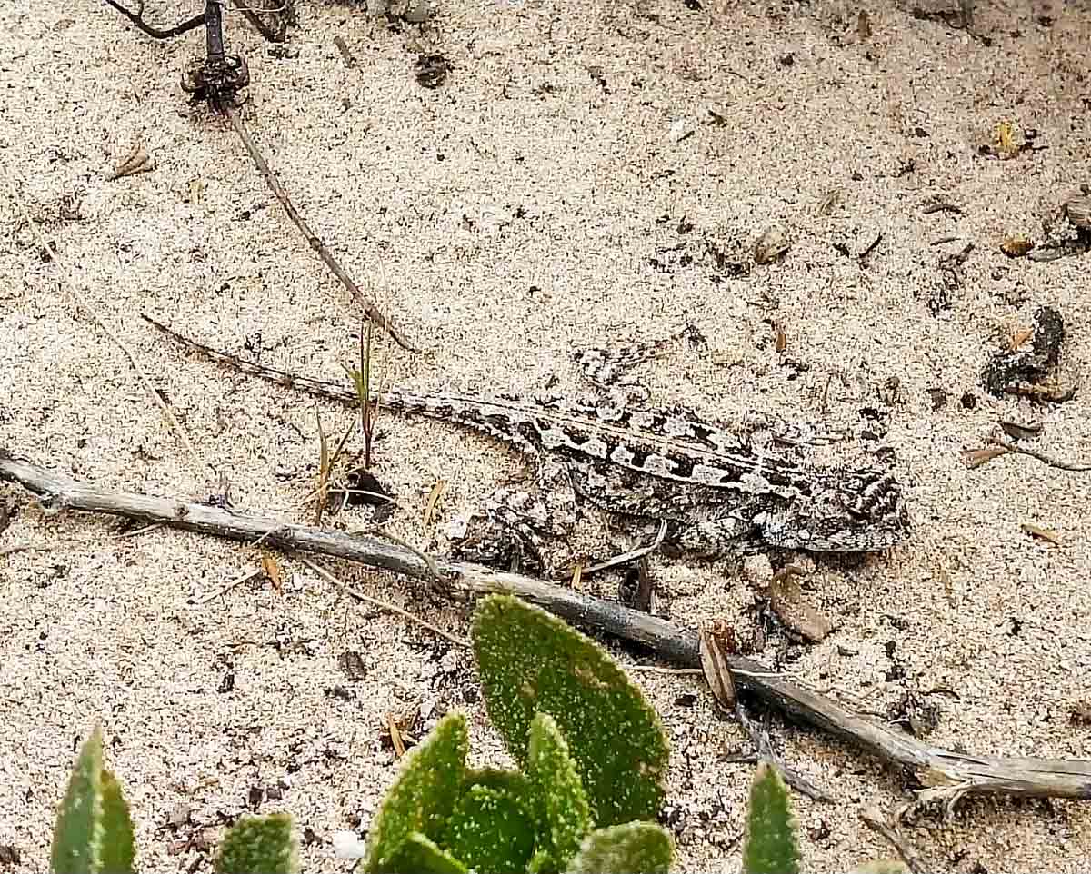
The terrain around this area was very rocky and had low lying shrubs. Look out for little lizards that blend into the ground! Near the lighthouse, you get scenic views towards Pondalowie Bay.
The lighthouse is still operational and is made out of stainless steel. I liked its look, it kind of reminded me of something from Doctor Who in the 70s. Exterminate!
West Cape Beach and Picnic Area
Next to the lighthouse, there’s access to West Cape Beach. We didn’t go down to the shore as it felt too windy for a walk but it looked like a lovely stretch of beach. The wind was serving up some pretty large waves and the colours were fantastic.
Near the capark, there’s a set of toilets and also a large picnic shelter. The picnic area is not the most obvious to find. If you head towards the toilet from the carpark, it’s just a little past this, there’s a short trail on the right. This is where we had lunch on our first day – it provides gorgeous views of the nearby bay and islands.
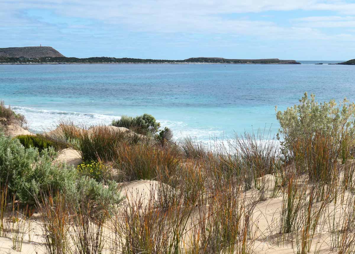
Pondalowie Bay (near the South Island)
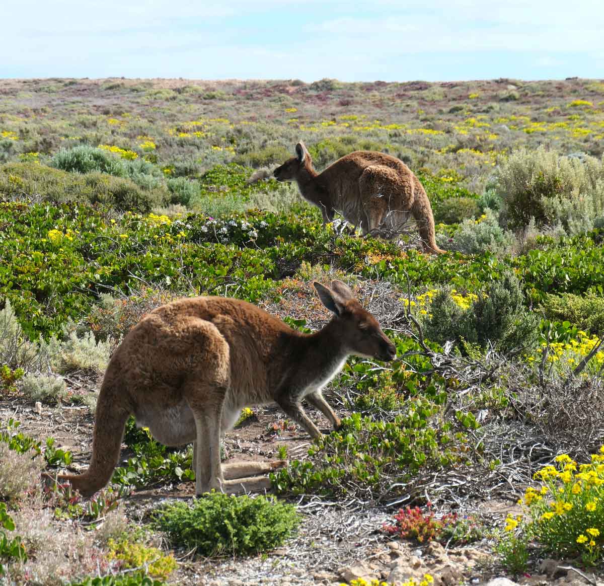
We walked around the clifftop trails here, you can expect more epic views of the ocean and rugged cliffs! We also went down a trail that was marked as part of Walk the Yorke where we saw a couple of cute kangaroos. It led down towards a rocky beach section of Pondalowie Bay, which seemed like a popular fishing spot.
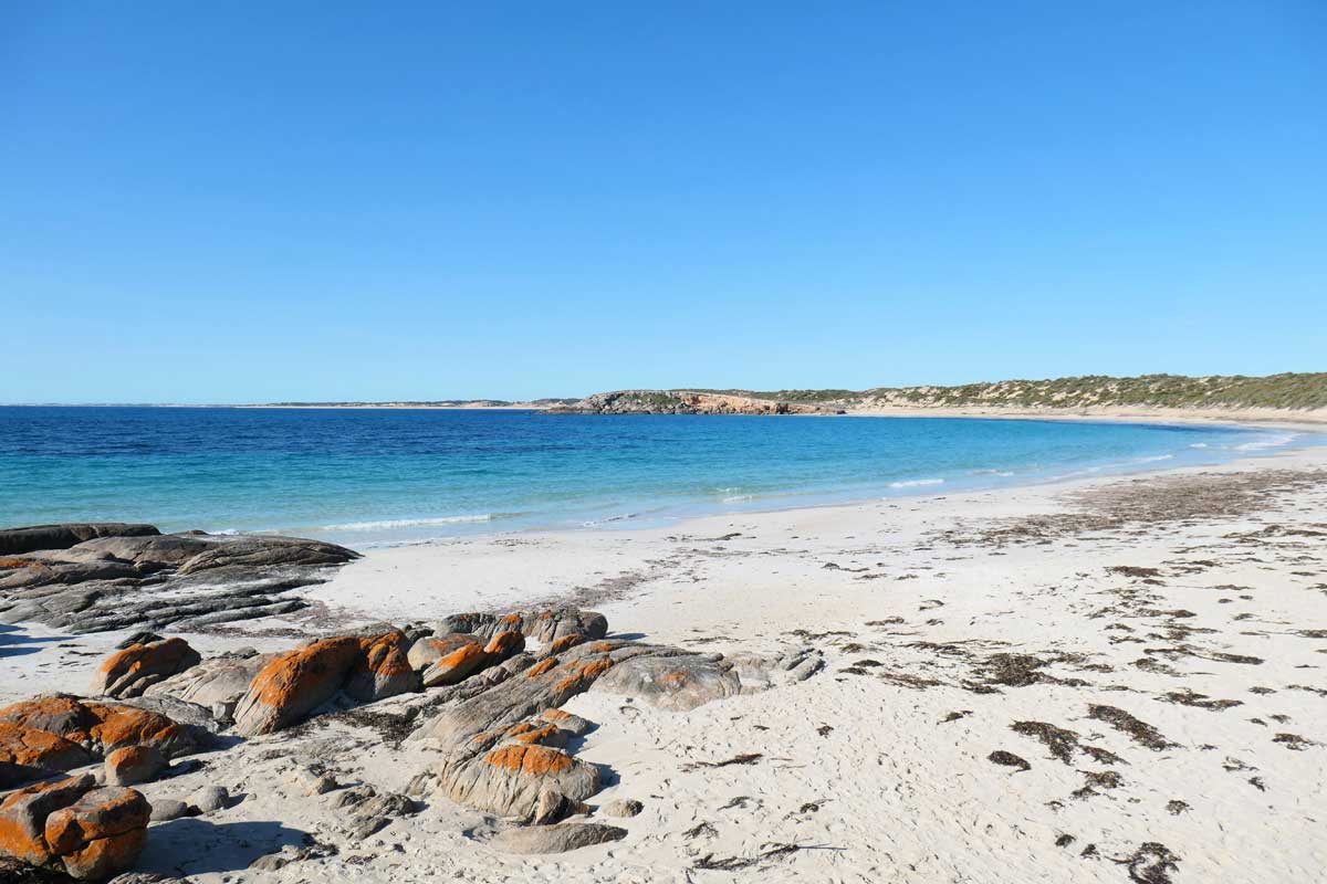
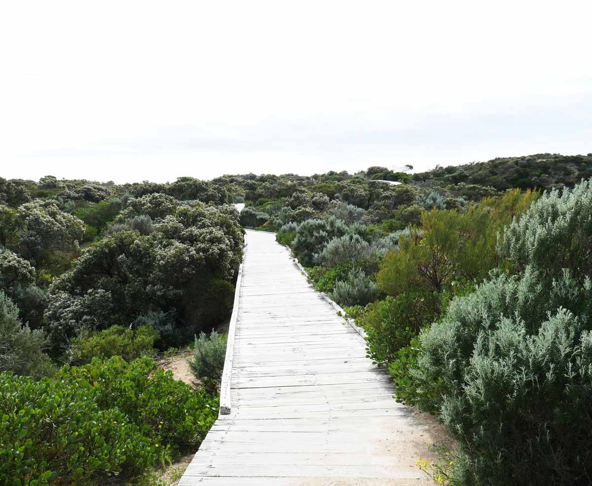
Pondalowie Boardwalk and Beach (Surf Break Carpark)
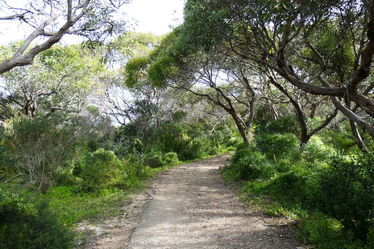
From the Surf Break Carpark, there’s a short walking trail that includes a boardwalk to get to the beach. The trail goes through some dense bushy vegetation and then along a boardwalk over the sand dunes.
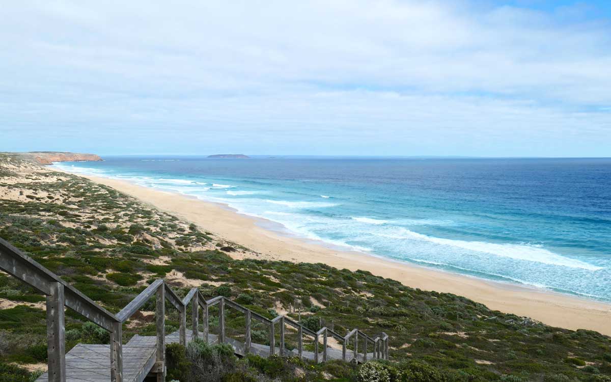
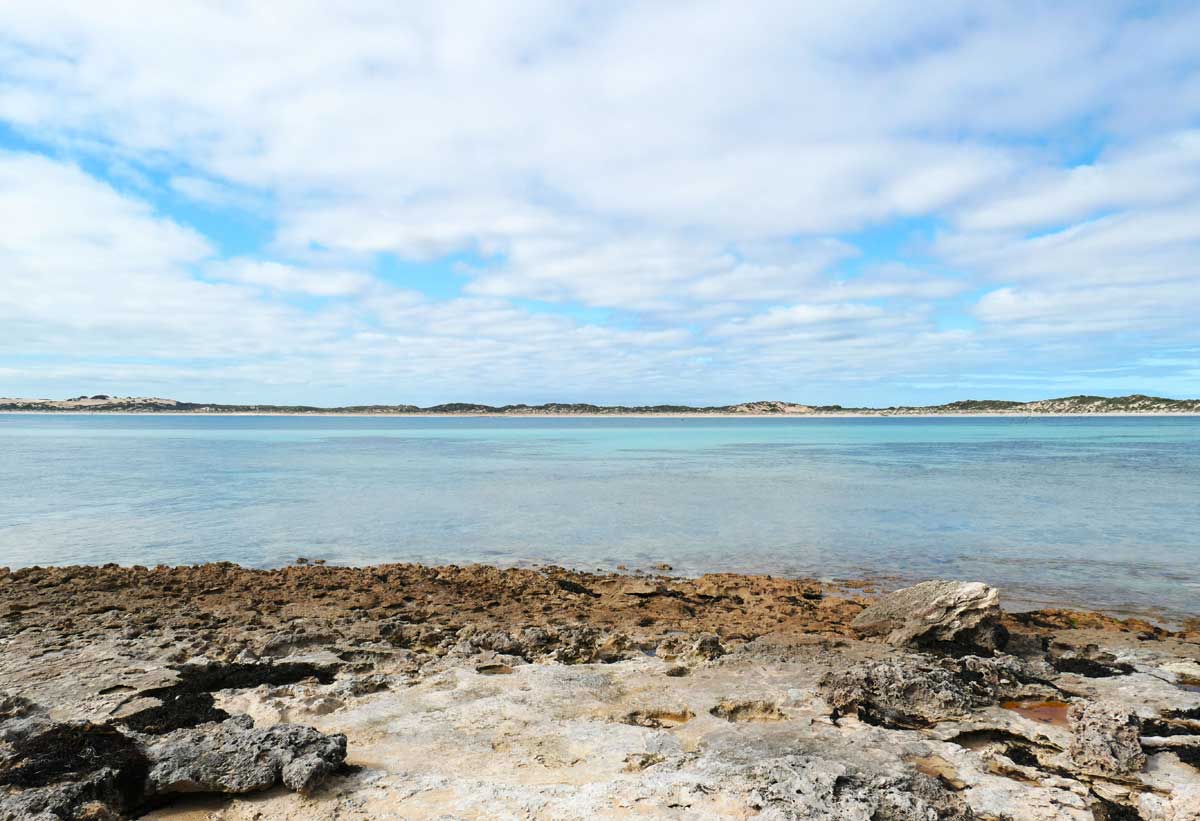
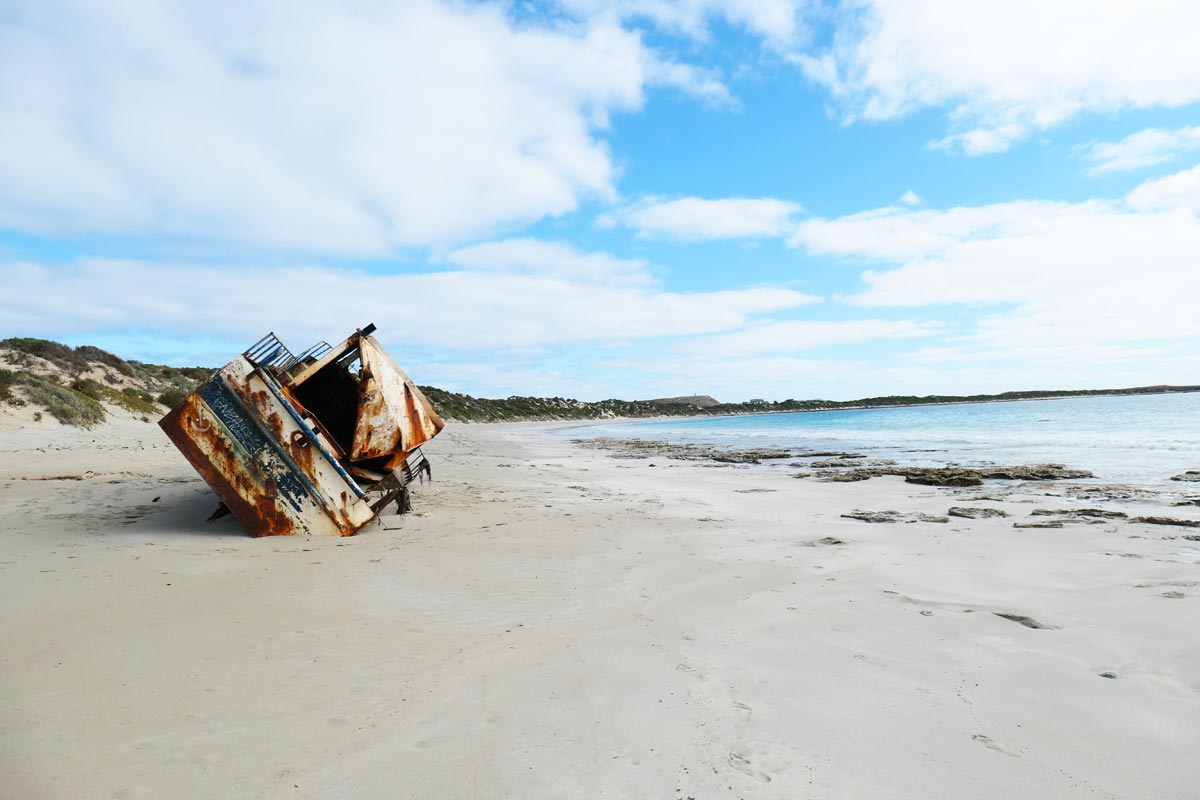
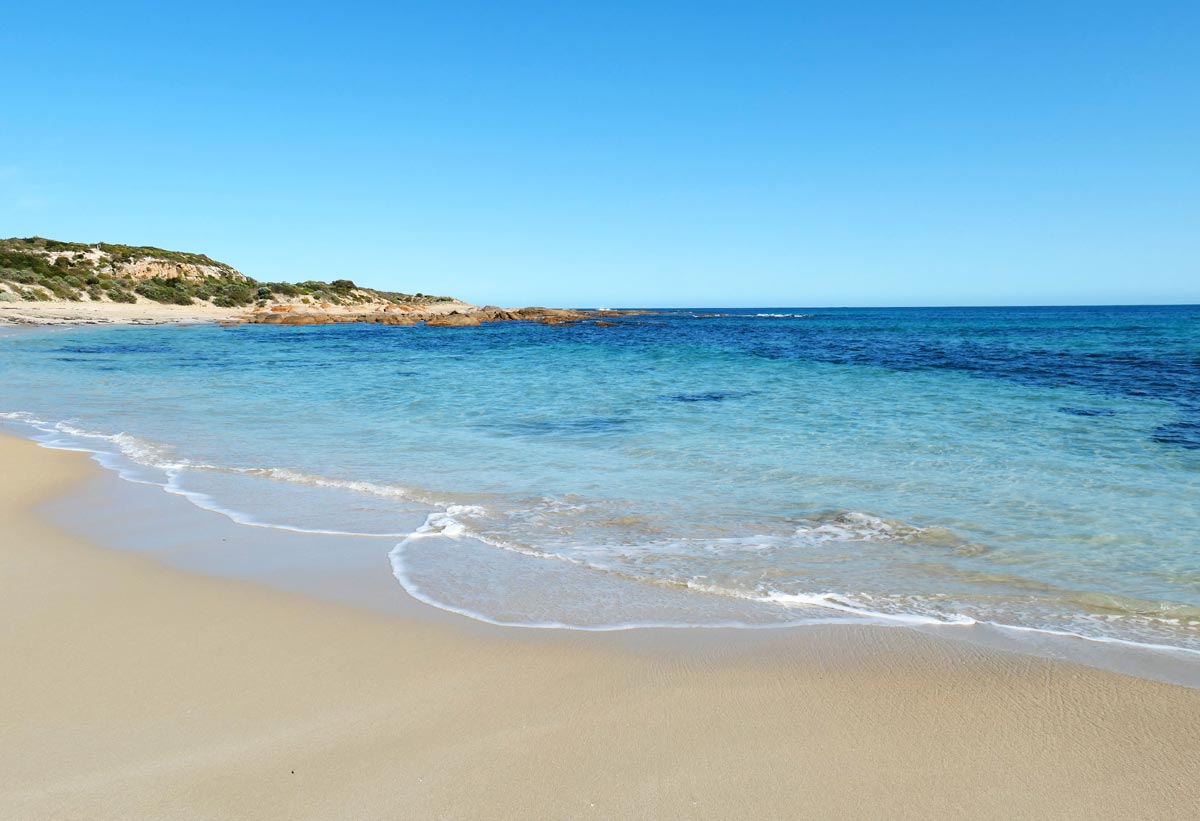
The long stretch of beach at Pondalowie Bay is beautiful with white sand. The water also looked much calmer than all of the other beaches. If you walk towards the left, you’ll come across a not-so-historical wreck, it washed up on the Pondalowie Bay shores about 2005 and it’s stayed there since.
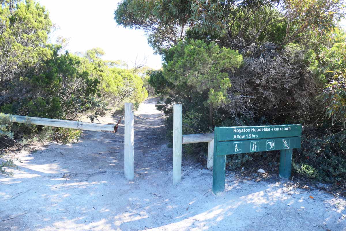
Royston Head Hike *
Oi vey! It was probably silly of us to do two of the longer walks on the same day but that’s what happened. We did the Gym Beach Hike before lunch and then the Royston Head Hike after. Our legs were absolutely done by the end of the day.
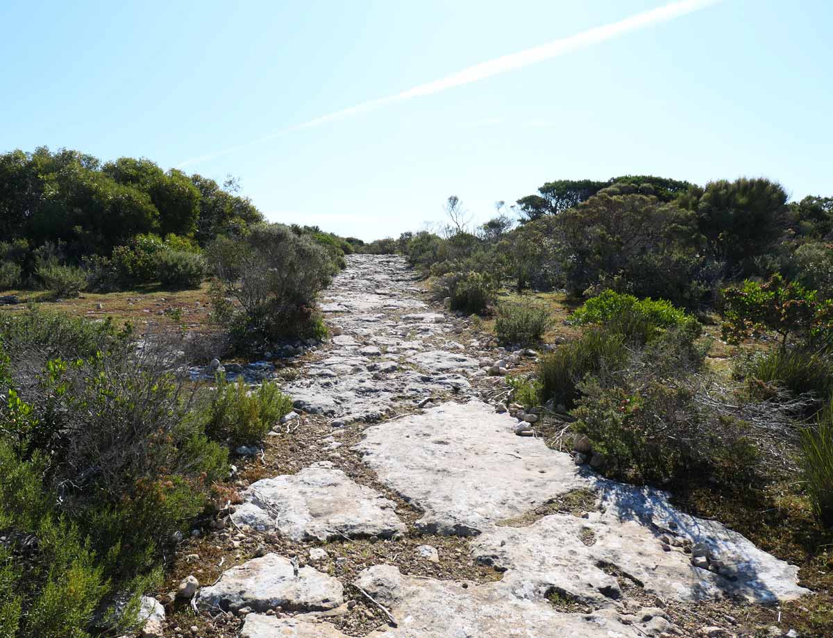
This a 4km walk return, although it felt longer than that?! Most of the trail is along a rocky path surrounded by low lying bushes and vegetation – I must admit, this part was a little bit so-so. There are signs along the way that tell you the distance you’ve walked.
It’s pretty flat until you get to the last kilometre where you walk up a bit of a hill. I think this is when the trail gets more interesting because it follows more of the coastline, and offers spectacular ocean views. It does get quite close to the edge, at least for me, it felt very close!
The path kind of peters out once you reach the sandy area overlooking North Island, but there’s no markers to tell you if it’s the end or not. We did see footprints where people must have walked along the cliff edge further! Uh, no thanks! I was satisfied with the scenic outlook we got from where we stood.
The views you get of North Island, the beach below and the rugged coastline was stunning. There is something a little Mediterranean about the landscape, what do you think? All in all, even though the start felt tedious, the last kilometre delivered the goods.
Dolphin Bay
I can imagine this little beach cove being idyllic in summer weather with its beautiful white sand and gorgeous water. When we went, there were heaps of seaweed along the beach but it was a bit windy. There’s a bit of a walk from the carpark to the beach, maybe 200-250m, with a short staircase at the end.
Shell Beach
Next to Dolphin Bay is Shell Beach, another gorgeous swimming spot to visit in summer weather! It also has a short 200-250m walk from the carpark to the beach, with a set of stairs to get down. There is a campground at Shell Beach, and toilets near the carpark. This is a much nicer toilet to use than some of the other ones!
We didn’t check out the rockpool at Shell Beach but if you walk over to the far right, and over the rocky terrain, apparently you’ll find a fantastic little rockpool with the clearest water. I want to check it out in the future, on a warmer day!
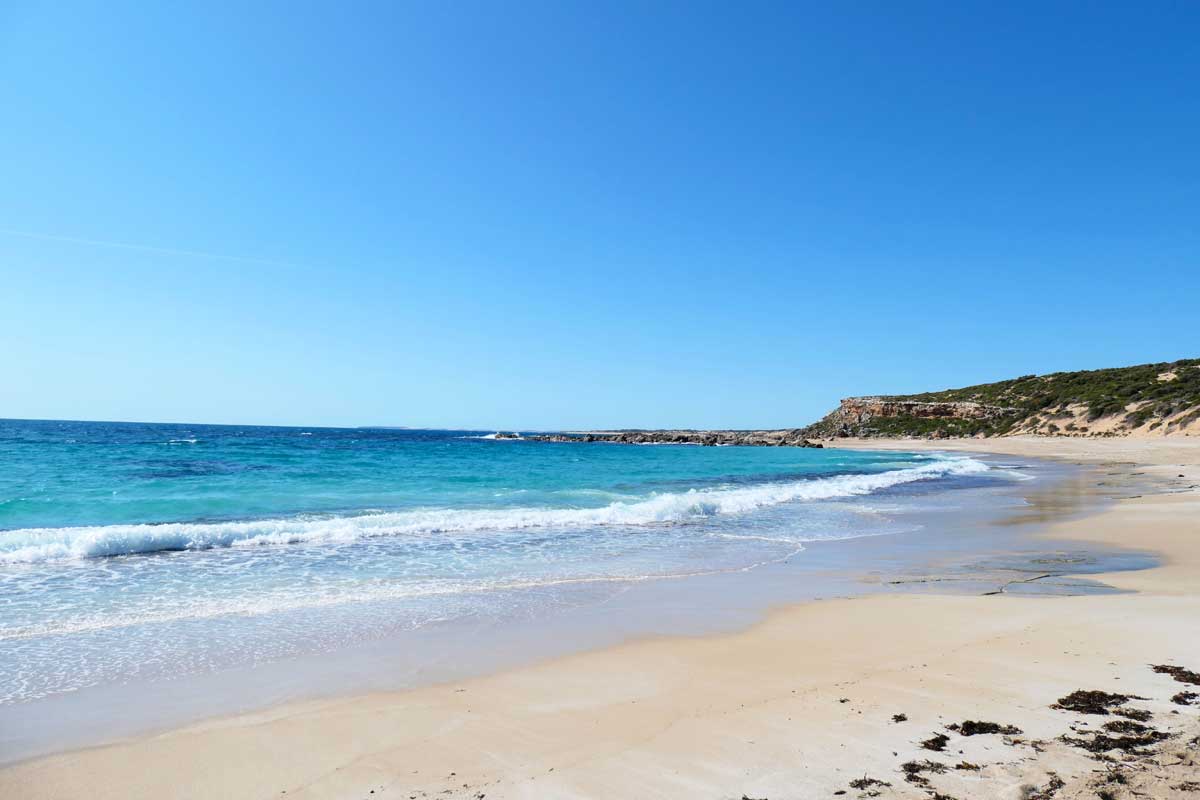
Browns Beach
Driving further up the main road from Shell Beach, you’ll come across Browns Beach. This is a much longer stretch of beach and another fantastic one to add to your list of summer swimming spots! It also looked like a popular location for beach fishing, we saw a couple of guys further off in the distance throwing their lines.
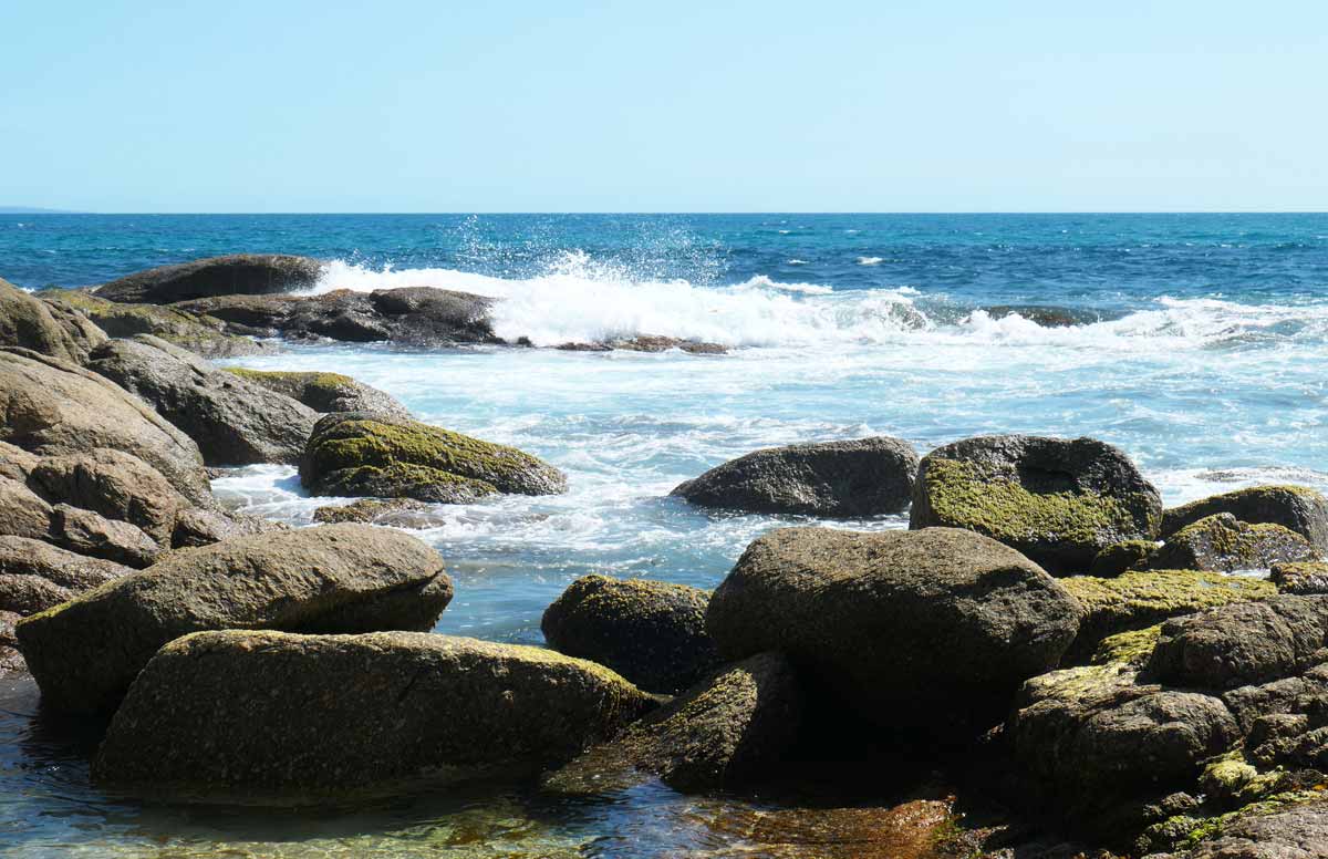
From the carpark at the top of the cliff, there’s about a 100m walk down to the beach. It doesn’t sound like much but it’s along soft sand, the climb back up is a workout for sure! To the left of the entrance, there’s a rocky granite area that’s fun to explore. To the right, there’s a long stretch of gorgeous beach.
On our second day at the national park after doing the Gym Beach hike, we decided to eat lunch here, on top of one of the giant granite boulders, surrounded by seagulls eyeing up our food. It was fabulous scenery watching the waves roll in.
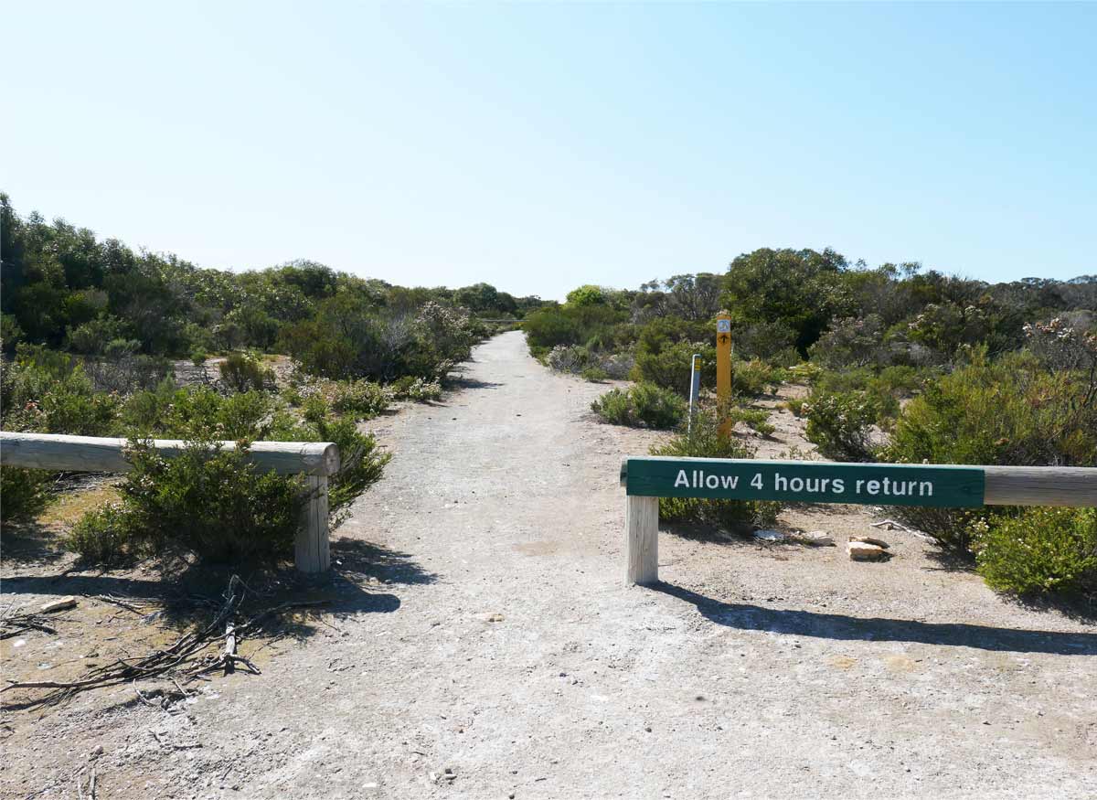
Gym Beach Hike
This is a long 11km return hike through coastal shrublands, which you can start near Browns Beach or on the other side near Gym Beach. There’s no vehicle access from Browns Beach to Gym Beach, to get there through the national park, you can only walk via the Gym Beach Hike Trail.
If you want to start at Gym Beach, you take the unsealed Gym Beach Road right down to the carpark in front of the beach. The beach itself and this road isn’t actually part of the Dhilba Guuranda – Innes National Park. I’m assuming that you won’t need to pay the vehicle entry fee because of this. From the carpark, walk back along Gym Beach Road about 500m, and the hike entrance will be on your right.
If you start from Browns Beach, it’s within the national park so you’ll definitely need to purchase a vehicle entry pass. Along Browns Beach Road, you’ll see a small carpark with signage for the hike. This isn’t the main larger carpark from the beach, it’s probably about 600-700m away from the beach.
We had to drop off Charlie at dog boarding which was kind of heading towards Gym Beach so we decided to start the hike from that end. I don’t know if it really made sense, I don’t think it did! I would probably say start at Browns Beach end, especially if you’re planning to see other things within the national park afterwards.
We had lovely weather but it got hot during our walk with the sun out, and there wasn’t much of a breeze. This meant that we were harassed by flies the whole time and we didn’t prepare for it. Learn from us, make sure to bring something for the flies!
The trail itself is fairly easy, there’s no huge hills to climb over. It’s along a dirt path with some rocky and sandy areas. You go through some dense bush with Mallee trees but a lot of the trail also goes out into the open or doesn’t provide much shading, so please make sure to bring sun protection.
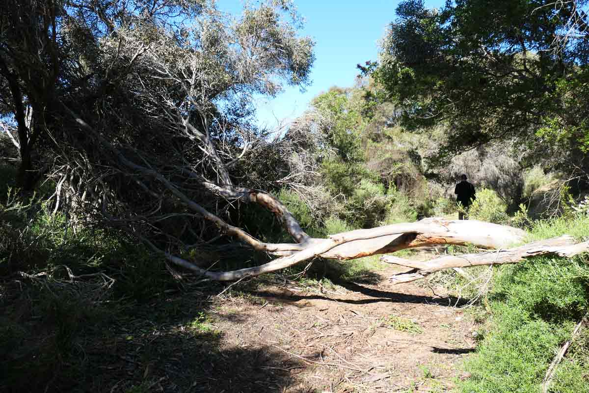
It’s interesting to see the variety of trees and shrubs in this part of the national park, and when you hit the sandy spots, it’s cool to see the high dunes. We came across a few fallen trees along the walk as we had some incredibly windy days before our visit. We didn’t come across any emus or kangaroos, surprisingly, but there were plenty of birds chirping and twittering.
I didn’t enjoy this hike as much as I wanted to but probably more because it got super hot and humid, there was no wind, and the amount of flies that bothered us the entire time was atrocious. It felt quite tedious, however, it might be more enjoyable on a cooler day with a bit more wind so it’s not as stifling!
Gym Beach
This looked like an incredibly beautiful beach, peaceful and quiet. As mentioned, it’s not actually part of the Dhilba Guuranda – Innes National Park. You don’t need to pay a vehicle entry fee to visit this beach for the day. It definitely looked stunning and worth going to in summer weather!
There’s a campground near the beach which IS part of the national park, you would need to pay a camping fee to enter and stay there.
I’m sure there’s a few I’ve missed but hopefully the above gives you an idea of the main sights and attractions you can visit at the national park.
The ones I’ve marked with an asterisk are the attractions that kind of stood out for me. I loved all of the beaches and would happily visit all of them again in better weather!
How many days do you need for your visit to Dhilba Guuranda – Innes National Park
My hubby and I spent a couple of days going around the different sights and it kind of felt jam-packed in a way. Because of the weather, it was too cold and windy to take advantage of any of the beaches so we didn’t spend as much time on them as we normally would.
Our itinerary for the 2 days
Day One
- Stenhouse Bay Jetty & Lookout Walk *
- Gulawulgawi Ngunda Nahgu – Cape Spencer Lookout
- Chinamans Hat (Lookout)
- Cape Spencer Lighthouse
- Inneston Historic Village Walk
- Ethel Beach Wreck
- West Cape Lighthouse & Headland Hike *
- West Cape Beach (just looking from the top)
- Pondalowie Bay (near the South Island)
- Pondalowie Boardwalk and Beach (Surf Break Carpark).
Day Two
- Gym Beach
- Gym Beach Hike
- Chinamans Hat (Carpark)
- Browns Beach
- Shell Beach
- Royston Head Hike *
- Dolphin Beach.
The ones I’ve marked with an asterisk are the attractions that kind of stood out for me. I loved all of the beaches and would happily visit all of them again in better weather!
We tried to do the sights in order as much as possible but then that meant two long hikes on the same day – you might want to plan it better!
You can visit quite a few places in 1-2 days. I would say 3-4 days is an ample amount to see most things at a relaxed pace. If you’re into chilling out at the beach, swimming, camping, snorkelling, fishing etc. – you could easily stay more!
Fauna and flora at Dhilba Guuranda – Innes National Park
While we were at the park, we saw plenty of emus. You can see where they’ve been because their droppings are everywhere, they’re shaped kind of like upside down cones with lots of seeds. We even saw some cute teeny tiny babies with their mumma. We also saw a couple of kangaroos near Pondalowie Bay.
Other animals that you might come across are brush-tailed bettong, tammar wallabies, hooded plovers, mallee flows, eagles, whales, dolphins and sea lions.
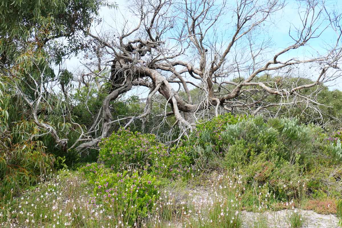
I’m not too familiar with wildflower and native plant names but as you would expect, the area has a lot of vegetation that thrive in coastal conditions. Australian wildflowers tend to be small and delicate, I saw plenty of bright colours against low lying shrubs. Along the trails, there’s a lot of Mallee trees or shrubs.
Preparing for your visit to Dhilba Guuranda – Innes National Park
Food and water
There are no grocery stores or food places within the national park. I would recommend bringing the amount of supplies you need for the length of your stay. If you find yourself missing something, the closest place to buy fruit, veg, pantry/household goods, fishing gear and the like, is the Marion Bay General Store, which is also a 24/7 fuel station and takeaway cafe.
And while you’re in the area, pop into the Marion Bay Tavern right next door, they serve great food and drinks!
Mobile coverage
Mobile reception is patchy within the national park. During the Stenhouse Bay Walk, I received messages (Telstra coverage), maybe because this is a high point in the area.
Safety and respecting the environment
- It’s important to stick to the designated walking and driving tracks for your own safety, as well as ensuring that you don’t damage the native vegetation.
- Before your visit, be sure to check the SA National Parks and Wildlife Service website for any warnings – the national park will close on extreme fire danger days. Pay attention to weather conditions, you might want to avoid going out on a long hike in the middle of the day if it’s summer or avoid swimming if there’s rough waves.
- Don’t try to go near any of the wildlife – emus and kangaroos can rip you to shreds!
- Don’t pick plants and don’t collect dead branches to use for firewood. Dead branches can be homes for many of the creatures at the park.
- Leave no trace of your visit, take all of your rubbish with you!
Gear
- Make sure you bring sun protection with you, especially if you’re out hiking or chilling at the beach. A beach umbrella or shelter would be handy on extremely sunny days!
- Flies were a big issue on the longer hikes, especially because there was no wind. Remember to bring some sort of repellant or wear one of those head nets.
- You might want to wear hiking boots or sneakers if you’re doing the Gym Beach Hike or the Royston Head Hike. The tracks can get rocky and they’re way too long for thongs!
And that’s a wrap!
I hope you’ve had a great time exploring the Dhilba Guuranda – Innes National Park in the Yorke Peninsula through this read. I wanted to provide as much information as I could for those of you planning a visit to the park and had never been. And dog pawrents, you don’t have to miss out! This is a fantastic South Australian national park, and I hope this journal entry has sparked your interest.
Have you been before? Please feel free to share your experiences in the comments or pop in any questions you might have; I’d love to hear from you. Safe travels and happy exploring! Thanks for joining me, hope to see you again!
Sheryl
Like this journal entry? Save it on Pinterest


Hey Pawrents,
Planning your dog-friendly Aussie Adventure?
Check out my interactive map full of amazing dog-friendly breweries, cafes, restaurants, pubs, walking trails, beaches and more.

I loved this post! So many great ideas on things to do and take pictures of 🙂
Thank you 🙂 There’s definitely heaps of Insta-worthy places at this national park!
Wow! So much great information for planning! I never thought of a doggy daycare so you can visit the National parks!
Thanks Melanie 🙂 I really wanted to get as detailed as possible for someone planning their first trip to the national park! Oh yes, I was worried whether travelling around Australia with a dog would be restrictive but so far, I’ve managed to find dog sitters, daycare or boarding.
Well this place looks so beautiful. I would definitely go here.
The nature here is absolutely stunning… Australia is such a bucket list destination for me!
I might be bias but I agree! Australia does have some pretty awesome natural attractions 🙂