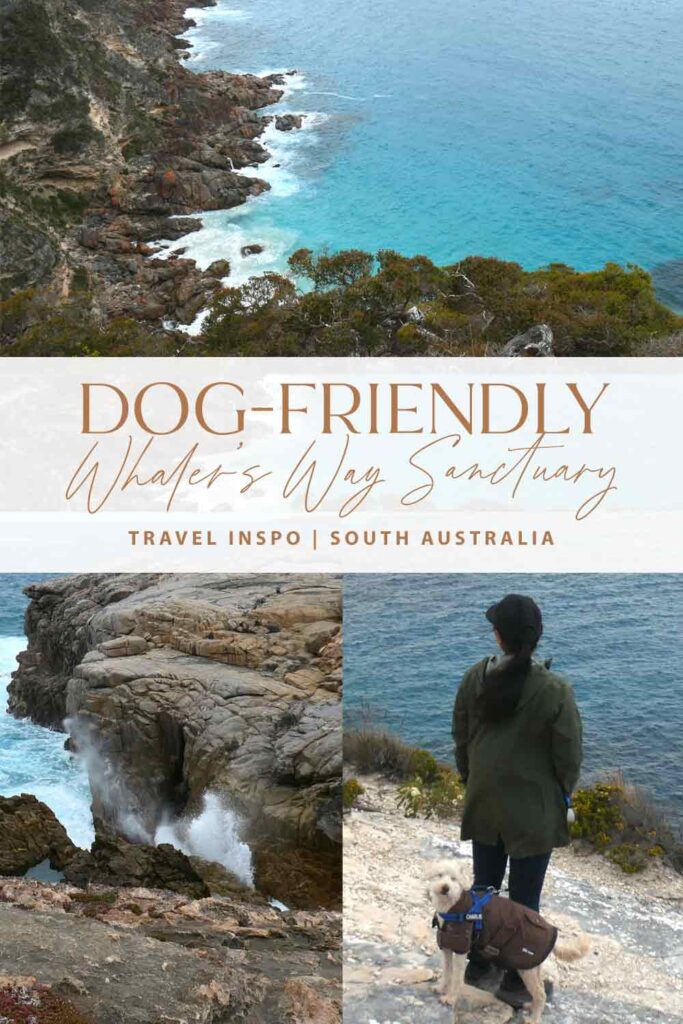
Whaler’s Way Sanctuary: A Dog-Friendly Coastal Nature Park
Hey there, friend!
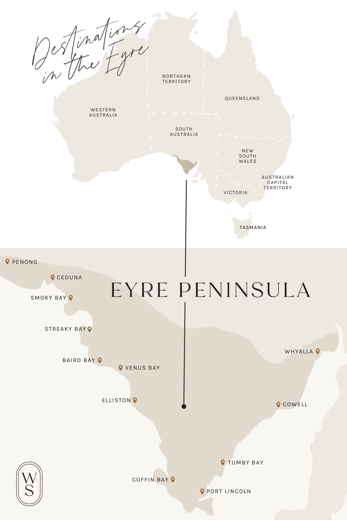
In this journal entry, I’ll be sharing our day trip to the dog-friendly Whaler’s Way Sanctuary, just a short drive south of Port Lincoln, in the fabulous region of the Eyre Peninsula, South Australia.
Whilst I love national parks—as I write this, my hubby and I have just visited three WA national parks in the span of one weekend—I always try to keep an eye out for alternatives that welcome four-legged friends. Whaler’s Way Sanctuary happens to be just that!
You might also like
When we travelled to the southern Flinders Ranges, we came across another gorgeous nature reserve that allowed dogs, Warren Gorge. This had a fabulous looped walking trail with epic mountain views. Click here to find out more!
Before you read on
I have a few journal entries for the Eyre Peninsula which I wrote before this one, that you might be interested in reading first.
Explore the Whaler’s Way Sanctuary in the Eyre Peninsula with me
Eyre peninsula Dog-friendly Nature Reserve
Whaler’s Way Sanctuary is a privately owned historic nature reserve in the southernmost tip of the Eyre Peninsula, South Australia.
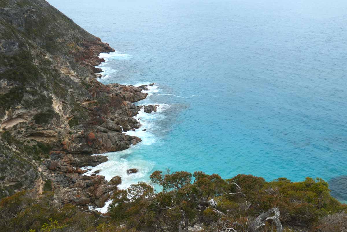
When you read about Whaler’s Way, many will mention its “rugged natural beauty”. I feel like this sums up the sanctuary’s landscape perfectly. Its southern coastline is beautiful, but in a wild and untamed way.
Not to mention that the sanctuary looks like it hasn’t been maintained since the 1960s. Haha. It’s as rough and ready as they come. Exploring this place was a bit of a crazy adventure, but we had a blast.
If you’re interested in finding out more, please read on. I hope you enjoy this journal entry!
Eyre Peninsula Map
Want to browse all of the Eyre Peninsula journal entries? Click here. If you would like to view an interactive Google Map of dog-friendly attractions, eats & drinks in this area, please visit my Dog-Friendly Aussie Map page!
How to get to Whaler’s Way Sanctuary from Port Lincoln
As mentioned, Whaler’s Way Sanctuary is situated in the southern tip of the Eyre Peninsula and the closest township to it is the city of Port Lincoln. This is about 33 kilometres north of the sanctuary, approximately a 30-minute drive.
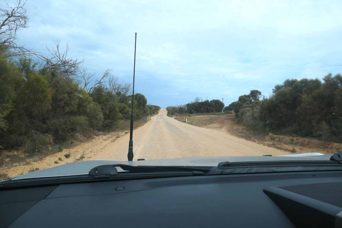
It’s all sealed roads driving down to Whaler’s Way Sanctuary from Port Lincoln, until you get to Fishery Bay Road. The rest of the roads from there are unsealed, but pretty well graded. The entrance to the sanctuary is just off Right Whale Road in Sleaford.
You might also like
We stayed in Port Lincoln and I’ve got a whole journal entry dedicated to our time in the wonderful township. If you’re looking for travel inspiration for the area, you can read it here.
About the Whaler’s Way Sanctuary & its history
When you purchase an entry permit online, it comes with a downloadable PDF brochure about Whaler’s Way. According to the PDF, works to develop the “wilderness park” began in 1969 by Robert Theakstone.
Judging from the rundown state of the park, no maintenance or further development has been carried out since then! It’s kind of nuts. The fee you’re paying is more than double what you would pay for a national park. This has gone towards… what now?
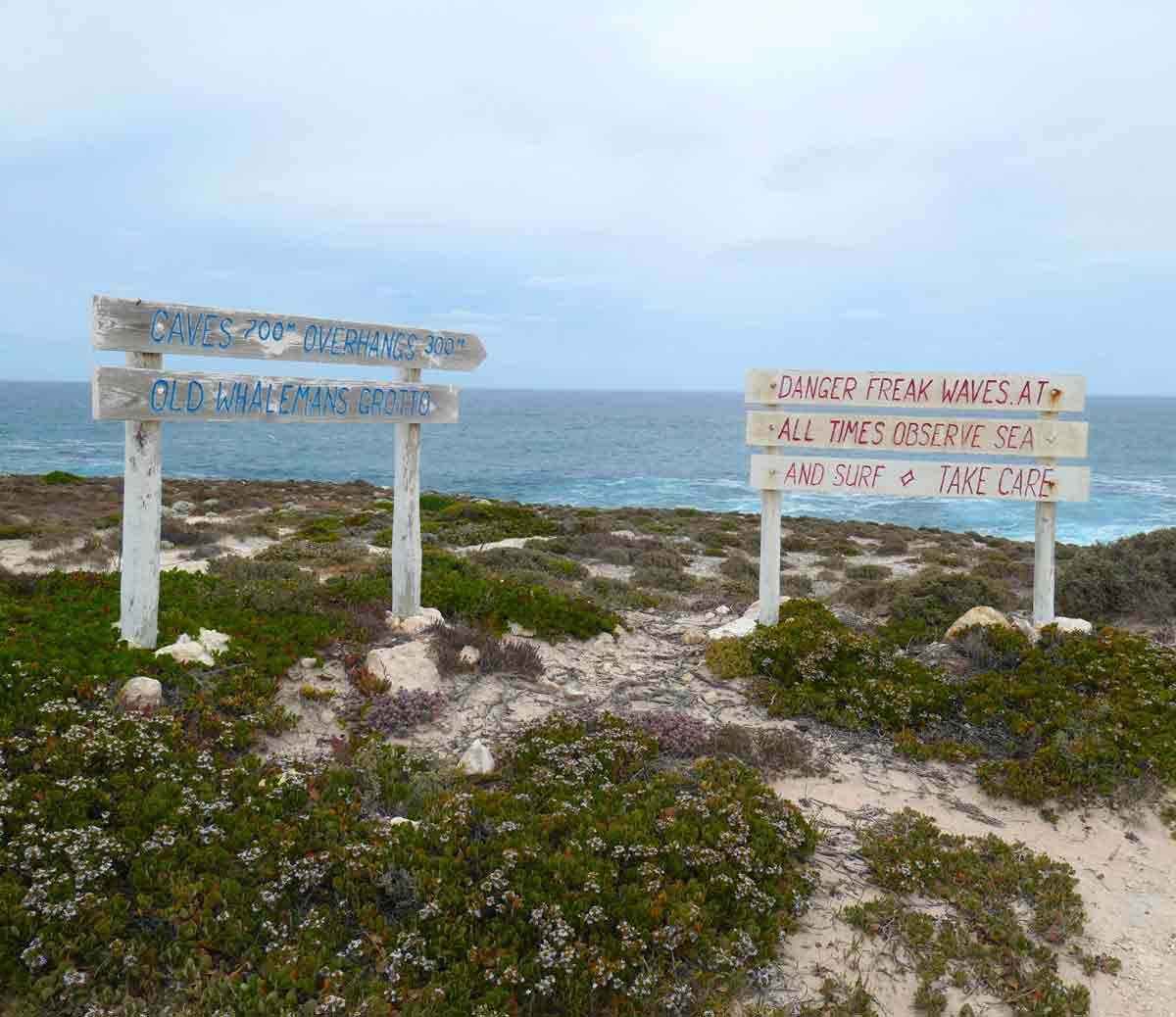
There’s very little information and signage throughout the sanctuary. And for the very few that exist, they look like they’re the original hand-painted ones from the ’60s, very faded and weathered.
Don’t get me started on the lack of general infrastructure. This place certainly makes you realise how luxurious state-run national parks are. I’m not kidding when I say it hasn’t been upgraded since the 1960s!
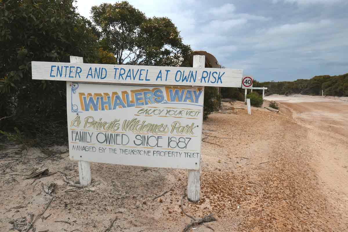
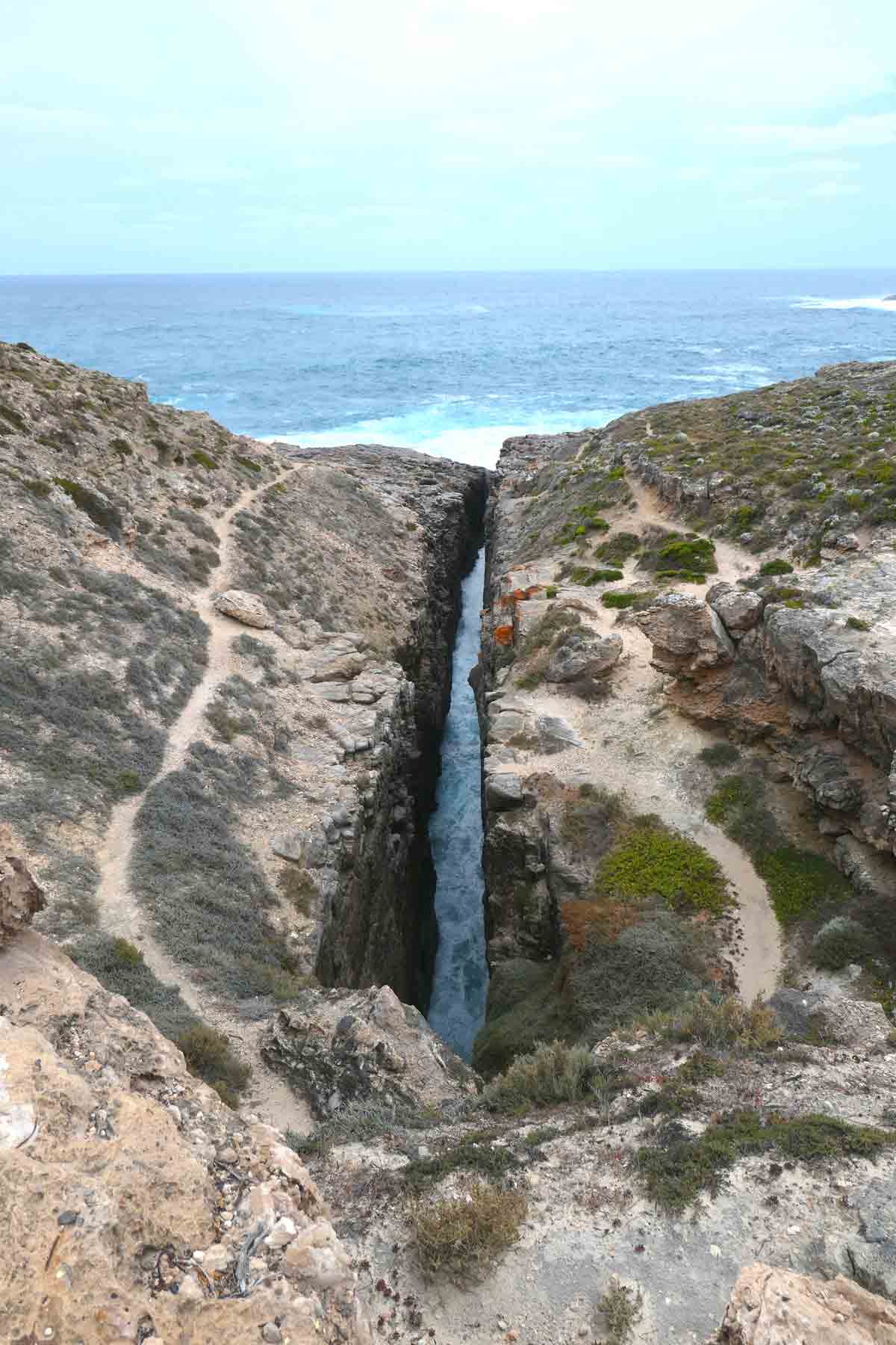
Okay, I got sidetracked there. Let’s get back to the history. The sign at the entrance says that the Theakstone family has owned and managed the area since 1887, and you’ll come across an interesting crevasse named after them.
The sanctuary was coined Whaler’s Way because of its close connection with the whaling activities at Sleaford Bay in the 1800s. Those poor gentle giants, at least they got the memo and started avoiding the area after a while, which led to the whale station shutting down! You go whale!
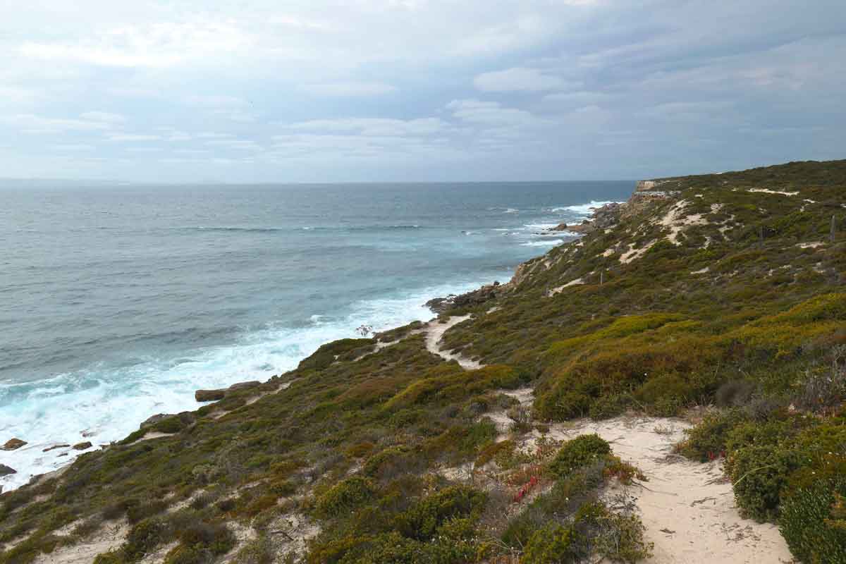
Natural rugged beauty
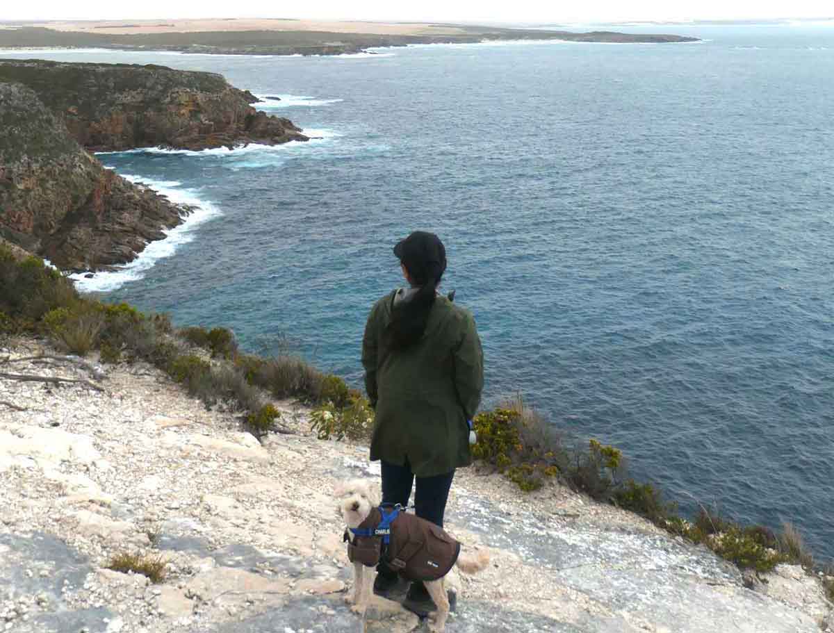
I know I haven’t exactly painted Whaler’s Way in the best light so far, but it does redeem itself by offering gorgeous coastal scenery. With the main benefit of being dog-friendly, that bumps it up quite a bit for me!
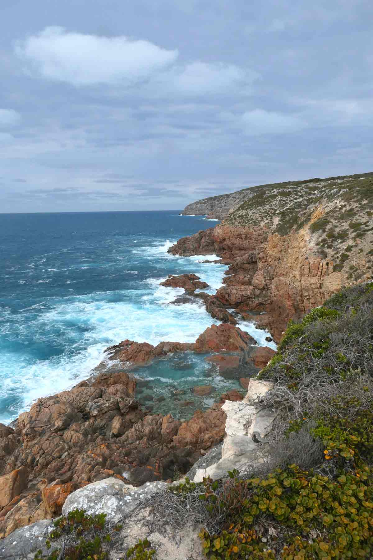
I found that the moody weather of the day actually accentuated the rugged natural beauty and remoteness of the coastline. The wind certainly made for dramatic waves crashing against the rocky outcrop of the cliffs.
Our day was enjoyable—walking along the top of the cliffs and soaking in all of the spectacular views, visiting the wild crevasses, caves, blowholes and rockpools. I honestly had a great time, despite all of the other stuff.
Exercising caution
On the City of Port Lincoln website, it says, “We urge all visitors to take care when visiting Whaler’s Way”. As you enter Whaler’s Way, there’s a sign that has the line, “Enter & travel at own risk”.
I think you get the gist that if you choose to enter this nature reserve, you must exercise some caution while making your way around. I would say that it’s not the most family-friendly, especially if you’ve got young kiddos.
In most Australian national parks, especially the popular touristy ones, you’ll find heaps of safety features implemented to make your experience as safe and easy as possible. For example: steps for steep ascents/descents, railings for sheer drops, handles if you need to pull yourself up to climb a rock, trail markers so you know where to walk etc.
Whaler’s Way Sanctuary has none of that.
No safety standard for sights & limited to no signage or information
Like I said, all of the signs and equipment feel like they’re the original from when they first opened the sanctuary. No upgrades have been made since then!
One of the attractions, which was a rockpool at the bottom of a cliff, was absolutely stunning. The surrounding coastline with pounding waves was a beautiful sight.
You can swim in the rockpool in good weather, but to get down to it, they’ve got a rickety, rusted-up ladder hanging off a chain. I’ve seen videos of people using it and getting down to the swimming hole, so it’s probably usable.
Personally, it looked dodgy and questionable, and I’m not sure I would!
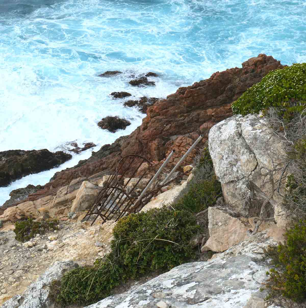
There’s no signs or information by the way with all of the sights, except for 1 or 2, where people have died and, I suppose, they’ve probably been forced to point it out. We came across the ladder at the swimmin’ hole by just exploring the area, not because we were informed.
There’s no trail markers for walks, like the Flinders Crevasse Walk, or sights that involve a bit of a walk through scrubland, like for Blue Whale Bay. So, you’re kind of left to find the track that looks the most trackiest.
We couldn’t find the supposed beach at Red Banks!
Poor road quality
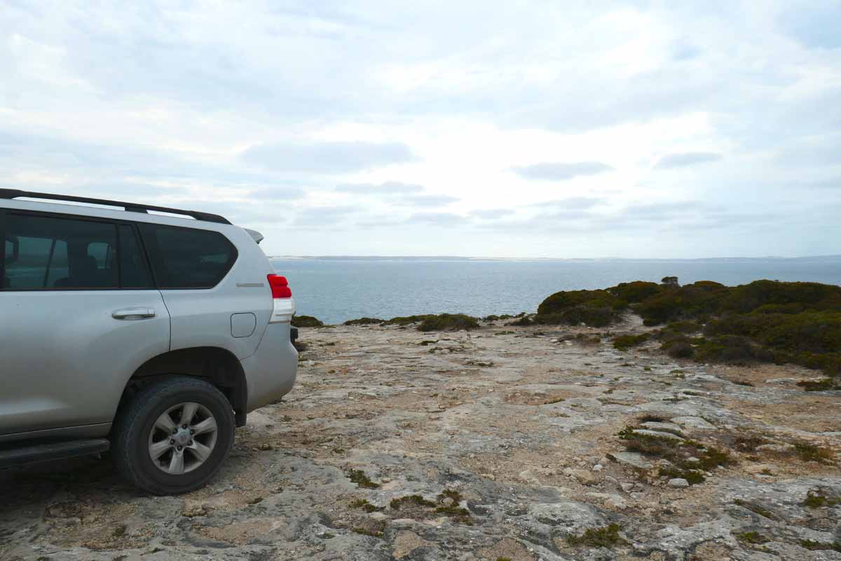
The main road within the nature park, Whaler’s Way Road, is approximately 14 kilometres and runs parallel to the coastline, with offshoot roads leading to various sights. It’s unsealed, and from memory, pretty well graded for the most part, although we did find some rough sections and surprise potholes.
On the City of Port Lincoln website, it says that the unsealed roads are suitable for 2WD & 4WD vehicles. However, based on our experience, I beg to differ!
If you’ve got a 2WD and very low clearance, you’ll likely find the roads rough. We saw a couple going around in a sedan and they were probably going 20 kilometres per hour. So, I guess the main sanctuary road is doable if you go slow and with care.
The roads exiting off to the sights are a different story. Holy moly. You would not want to be driving a 2WD or low clearance vehicle on some of these tracks, especially towards the swimming hole and crevasse. I can’t stress how rocky and uneven they were.
Lack of parking & poor quality car park spaces
For many of the sights, there isn’t much in the way of parking or even space for turning around. The reserve really hasn’t been well maintained or developed for tourists to come through. Some of the car parks are rocky as hell.
What time of year is best to visit
We stayed in Port Lincoln for about a month (late October to mid-November) and the weather in the southern Eyre Peninsula was hit-and-miss the entire time.
On the day that we went out to Whaler’s Way Sanctuary, about mid-November, it was chilly, grey, moderately windy with on-and-off rain.
I would say the best time to visit is in summer, so it’s hot enough to actually take a dip in the unique swimming hole or at one of the beaches (if you can find them!).
According to the Whaler’s Way brochure (downloadable when you purchase a permit), wildflowers are abundant from August to September. However, the weather may not be the best in those months.
It’s crucial to check weather conditions before you go, you want to avoid days where it’s extremely wet and/or windy as it’s a very rugged coastline and the roads are all unsealed.
Purchasing an entry permit (includes one night of free camping)
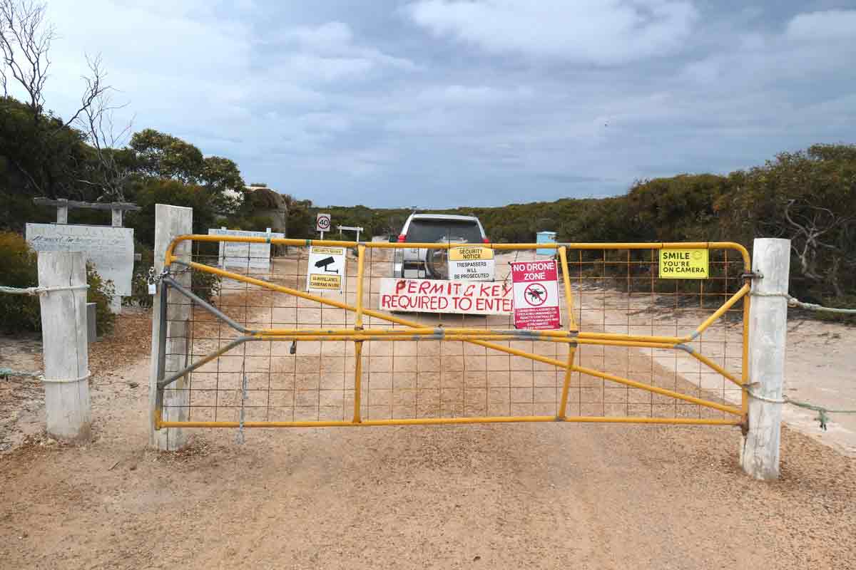
Whaler’s Way Sanctuary is privately owned and the reserve is gated. To enter, visitors need to purchase a permit, which costs $40 per vehicle for your selected date. This also includes one night of free camping.
The easiest way to purchase a permit is through the City of Port Lincoln website. Please note that there is a $3.20 online booking fee.
After purchasing a permit, an email will be sent which includes an access code for the entrance, and a downloadable PDF brochure with information about the sights, history, and a mud map of the area.
Alternatively, you can pop into the Port Lincoln Visitor Information Centre located in town on Tasman Terrace, near the foreshore.
It’s important to note that there is no pay station or manned office at Whaler’s Way Sanctuary, you must purchase your permit beforehand.
Camping & additional nights
It seems possible to camp at Whaler’s Way Sanctuary for more than 1 night; you can arrange additional nights by booking in person at the Port Lincoln Visitor Information Centre. According to the City of Port Lincoln website, it costs $10 per additional night.
You can basically camp anywhere that’s not obstructing any roads. From what we could see, people seemed to have camped at Red Banks and at the Barbecue Area.
Park opening hours & access code
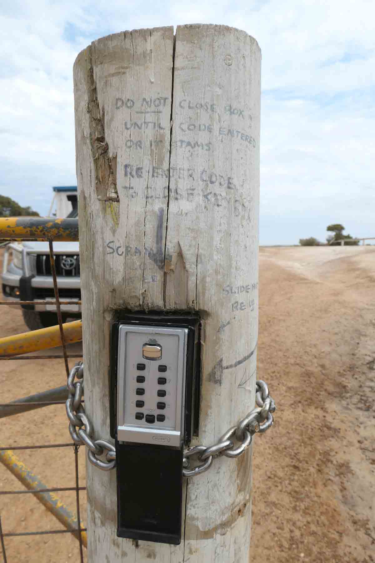
I can’t find official opening hours for the reserve but I’m pretty sure as long as you have a permit that matches the date you’re there for, you can enter when you like. You will need an access code to enter and exit the reserve.
At the gate, you’ll find a locked box with a key inside. Enter the access code, grab the key and open the gate. Once you’ve driven through, you need to close the gate and place the key back inside the locked box.
You’ll also need to do the same to exit. Don’t worry, there are instructions written on the gate post… with just a permanent marker.
Sights & places to see at Whaler’s Way Sanctuary
This is a list of the attractions we saw while we were at the reserve. We might have missed a few, but I think we covered the main, interesting ones. You can explore Whaler’s Way within a day, especially if you’re not swimming.
If you’re a keen walker or hiker, unfortunately, there are no long challenging walks or hikes available at the sanctuary. It’s really more of a scenic drive, where you visit viewing points at the edge of the cliffs and take in the beautiful scenery that way.
Some of sights that stood out for me were:
- Pelamis Point
- The Swimmin’ Hole
- Calson’s Cove
- Blowhole & Baleen Rockpool (Cape Carnot)
- Theasktones Crevasse.
Pelamis Point
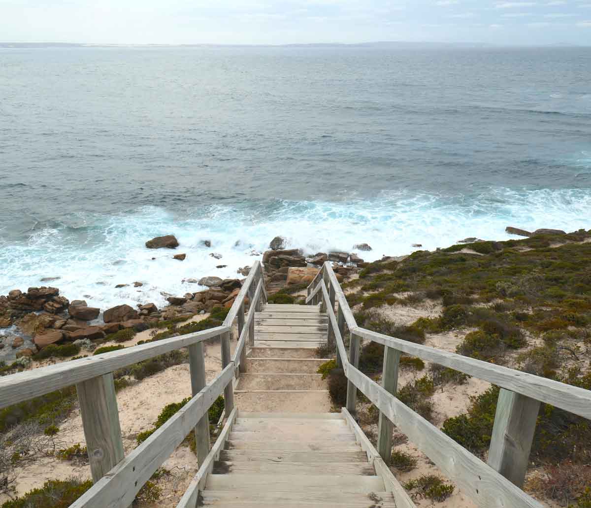
This spot offered beautiful cliffside views of the coastline and of Fishery Bay. There were some lookout platforms and stairs leading down to the water. It also looked like there was a trail you could walk along.
The Swimmin’ Hole
The swimmin’ hole is a large rockpool down at the bottom of a cliff, maybe 4 or 5 metres down? I’m terrible with heights. To get to it, you have to climb down the cliff face via the most dodgy-looking rusty metal ladder.
We had gloomy wintery weather so there was no swimming for us that day. However, it made for epic swells and the swimming hole looked dramatically stunning.
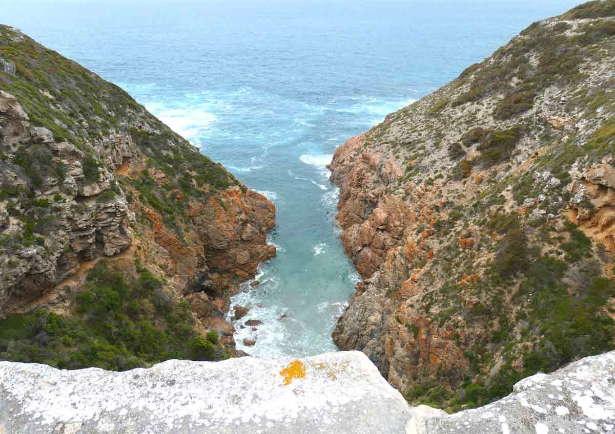
Whalechaser Crevasse
Another cliff area with an epic view of the coastline, this one showed a large crevasse down the bottom. You can get super close to the edge but be very careful of crumbly or unstable sections!
Try Works Cliff / Calson’s Cove
From the car park, we walked a short distance to the edge of the cliff. Again, there’s not a lot of markers or information to say where you’re supposed to go, you’re kind of just left trying to find anything that resembles a trail.
The jagged coastline views from the edge of the cliff were gorgeous and the water was a stunning colour. The cliff side we saw was interesting because it had caves all throughout.
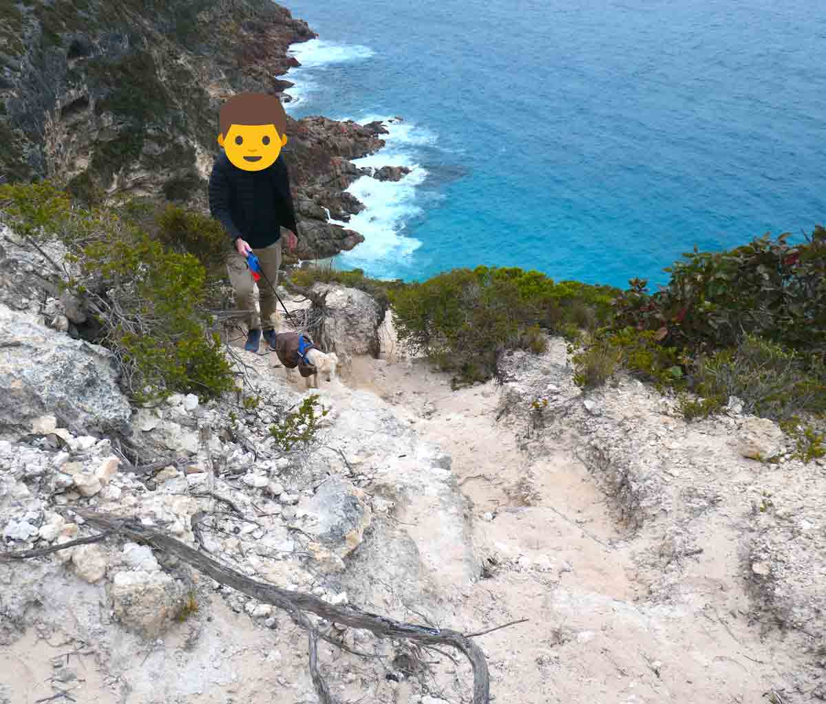
We walked down the cliff’s side on what seemed like somewhat of a path, it was very rocky, crumbly and narrow. It was kind of scary to be honest, but the scenery was awesome!
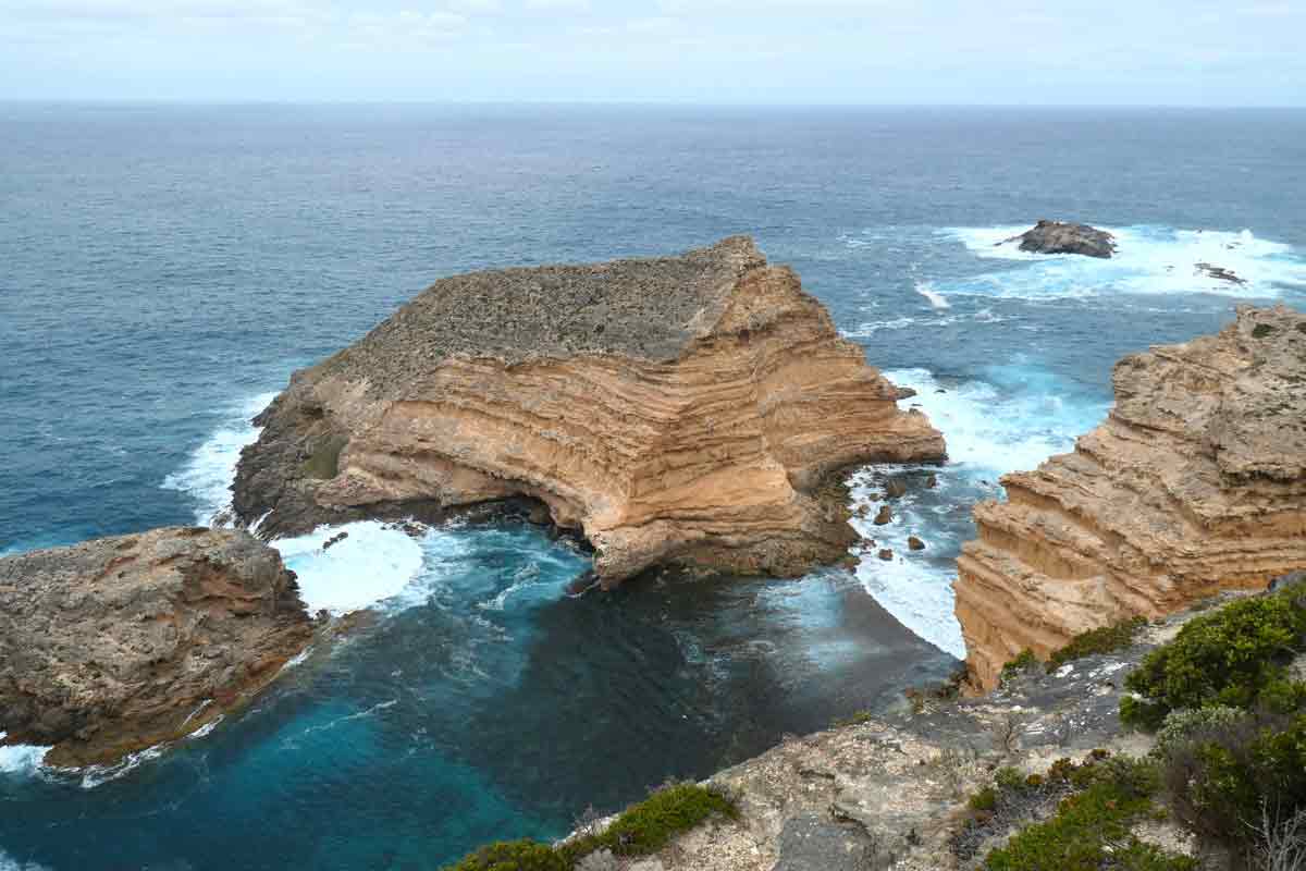
Cape Wiles
Wow, this sight actually had fencing to protect you from the edge. It’s probably a good thing because you’re up about 106 metres high. The wind picked up while we were here, I felt like I could’ve been blown away.
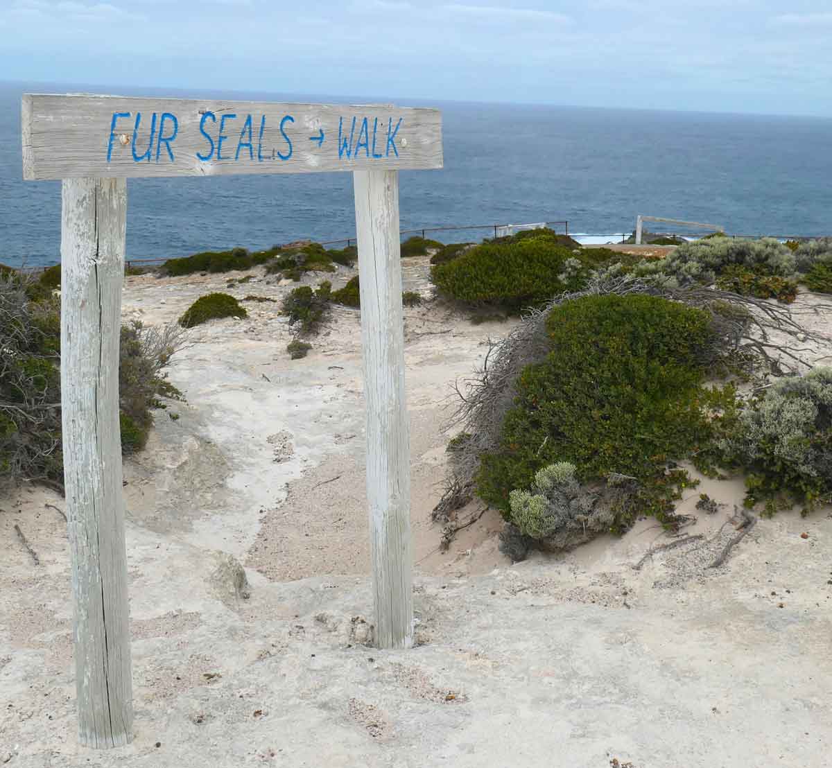
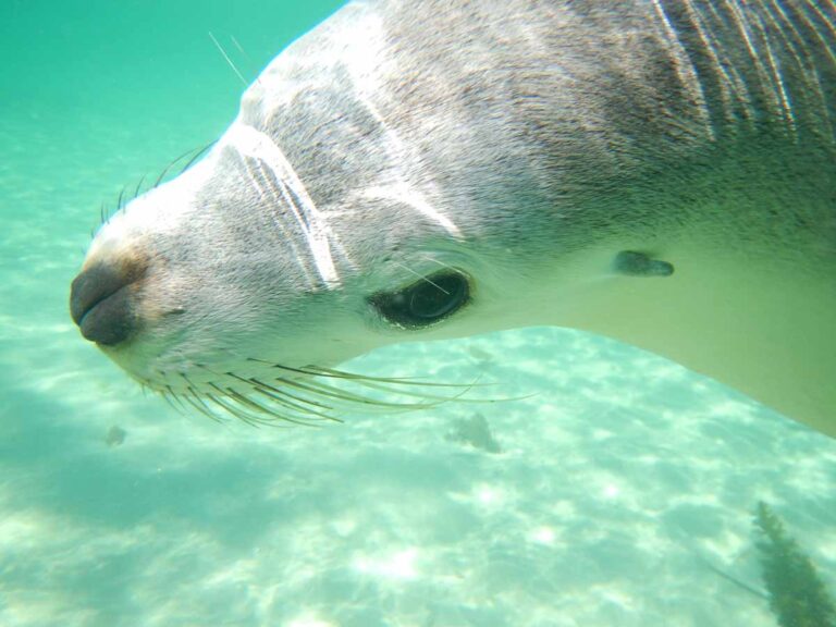
There’s some unique rock formations at the bottom of the cliffs. Apparently, there’s a seal colony based at Cape Wiles, but unfortunately, we didn’t see any.
Blue Whale Bay
From memory, this had a short walk to it which wasn’t marked and the trails weren’t clear, but we got to the cliff edge in the end. While it’s no Great Australia Bight, the sheer cliffs did offer amazing views from a height of 122 metres.
Sinkhole
This was not worth driving to, it’s not a very epic sinkhole like some of the ones you see in Mount Gambier. If you don’t have time, you wouldn’t be missing out too much.
Moonlight Bay
This place offered cliff views but didn’t seem as epic as the other ones. Another sight where if you don’t have time, you wouldn’t be missing out too much.
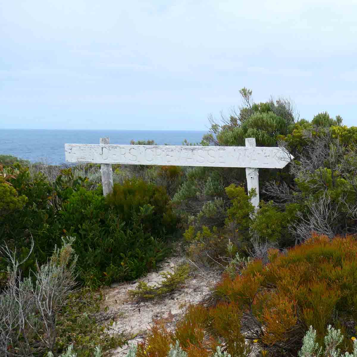
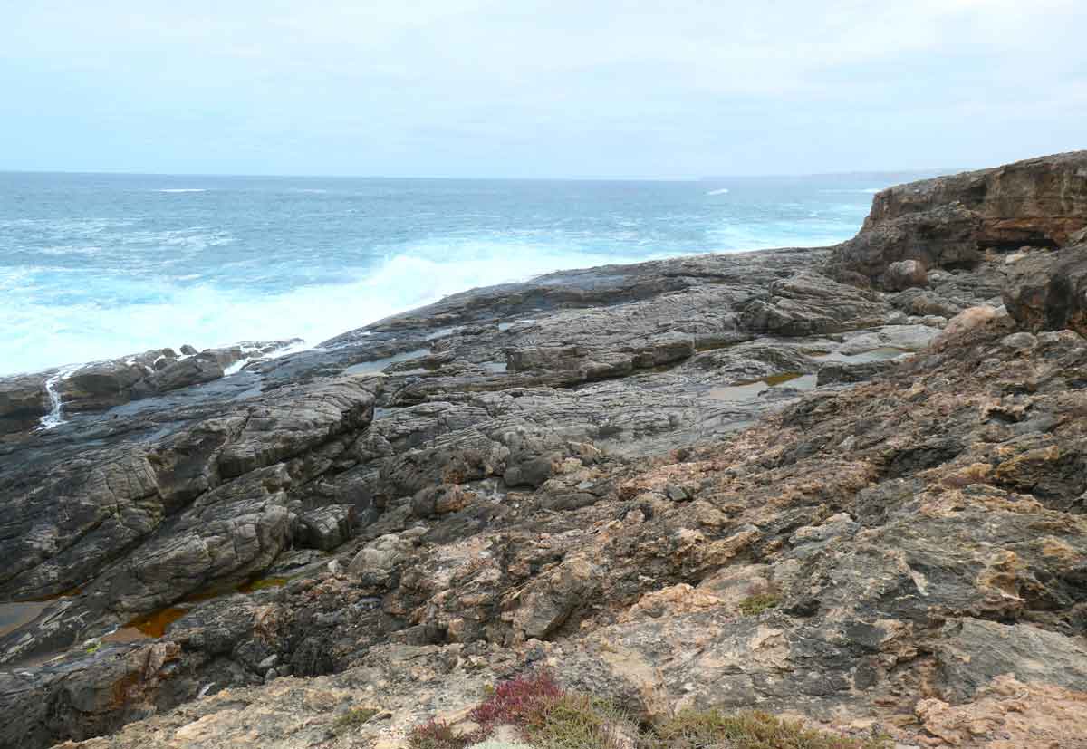
Flinders Crevasse Walk
This was a fairly easy walk. I can’t quite remember the distance but I don’t think it was very long. There weren’t really any trail markers, we just tried to walk along what looked like a trail at the top of the cliffs.
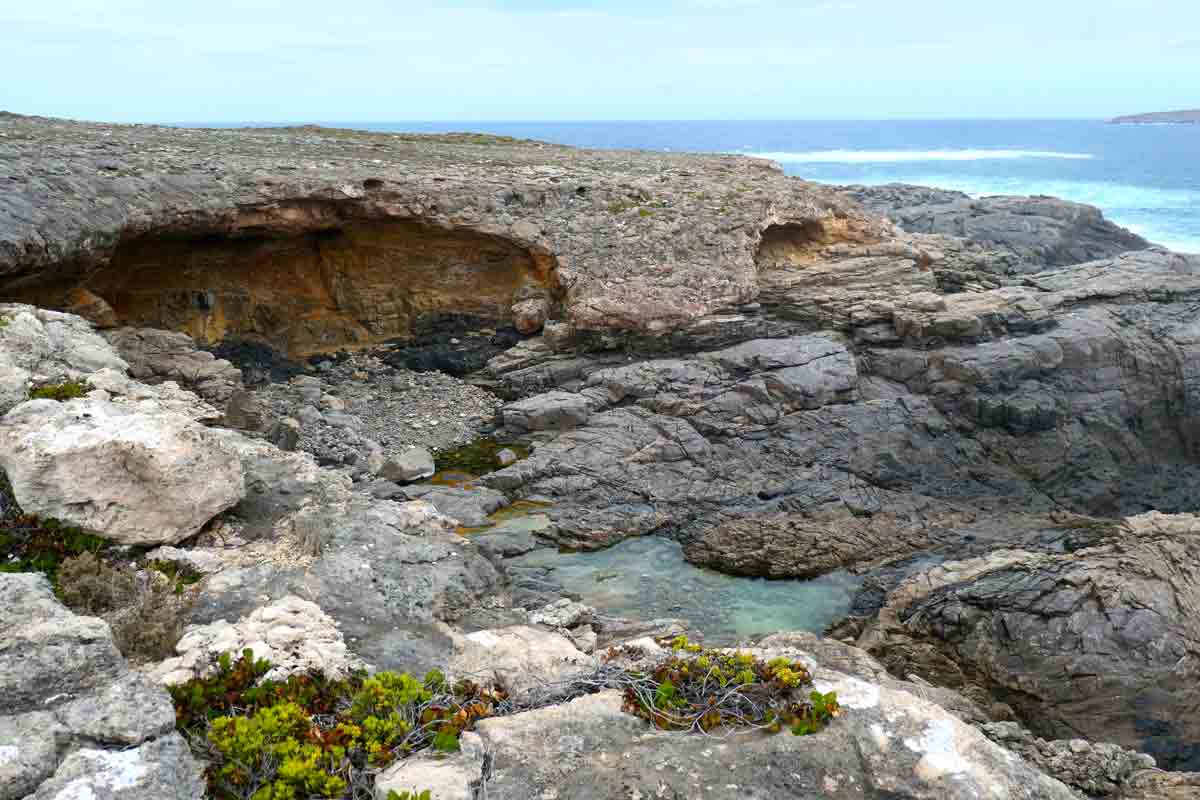
We walked towards the crevasse which was pounding with waves and was very rocky. We also came across a section of coastline with large caverns and some rockpools.
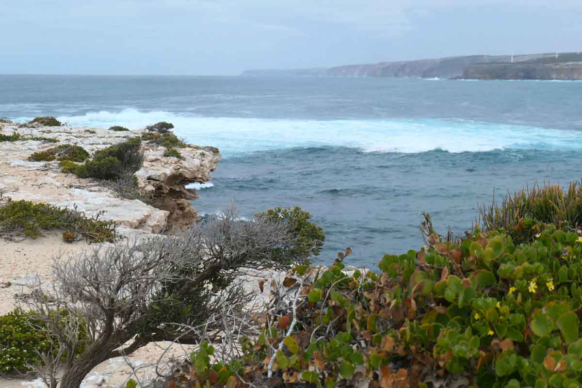
Blowhole & Baleen Rockpool (Cape Carnot)
We had huge swells because of the weather, it was fantastic to see the waves crashing onto the rocks. With this sight, there’s actually a sign marking the point where you can’t go any further.
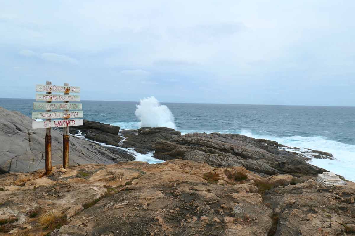
It’s extremely important to heed the danger warnings in this area, as four people have died here. All it takes is one freak wave, which can happen unexpectedly.
It’s hard to know if you’re looking at the right thing for the lack of signage and information, but I think I spotted the blowholes and rockpool towards the left. I think when the weather is better, you could possibly take closer photos of the rockpool.
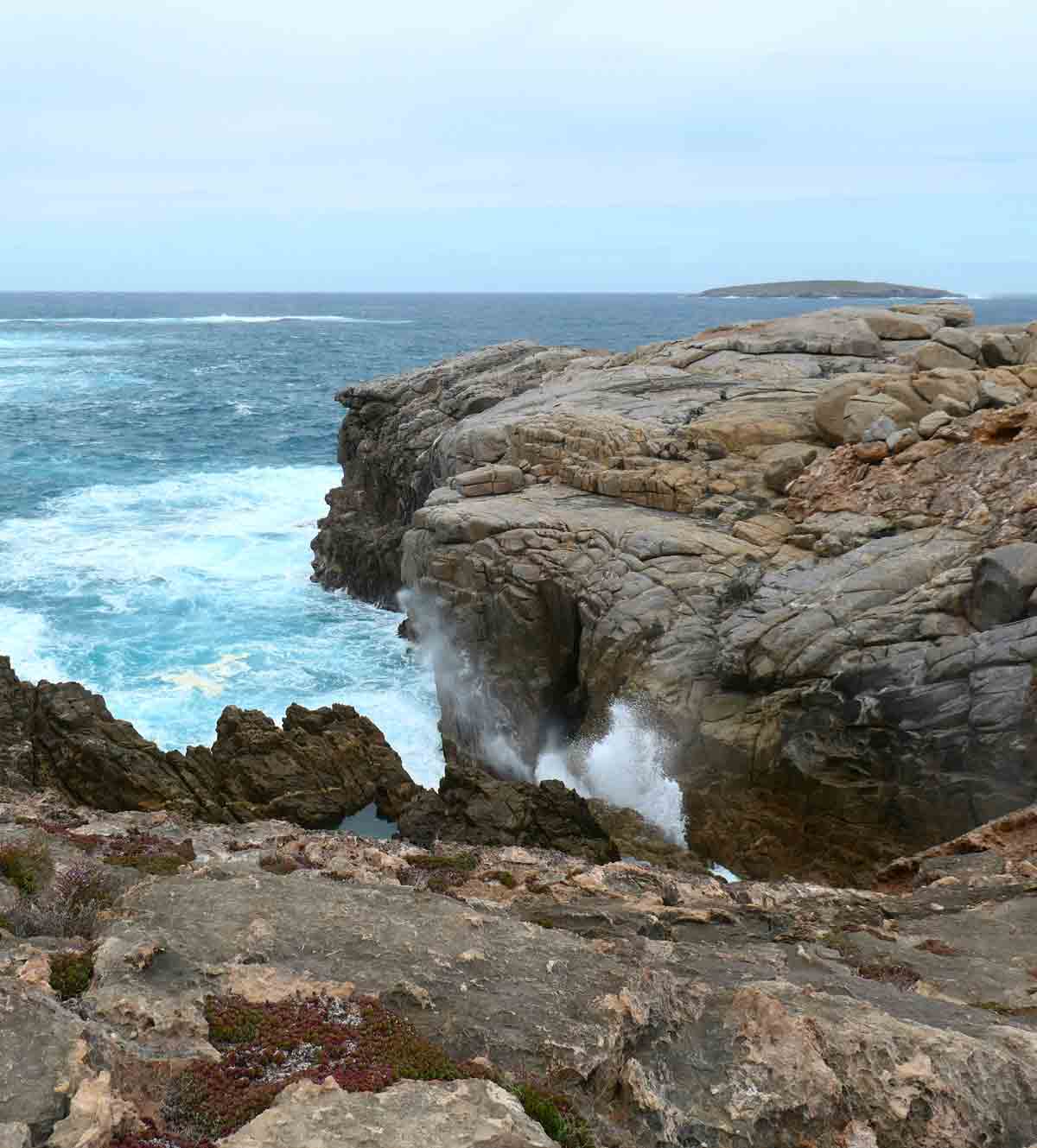
Caves & Old Whaleman’s Grotto (Cape Carnot)
From the Blowhole & Baleen Rockpool, we walked over to the Caves & Old Whaleman’s Grotto. The ocean was very rough and the surface of the rocks were very sharp.
I’m not really sure where the caves were. Perhaps in better weather, you could actually go down further and explore the rocky area below.
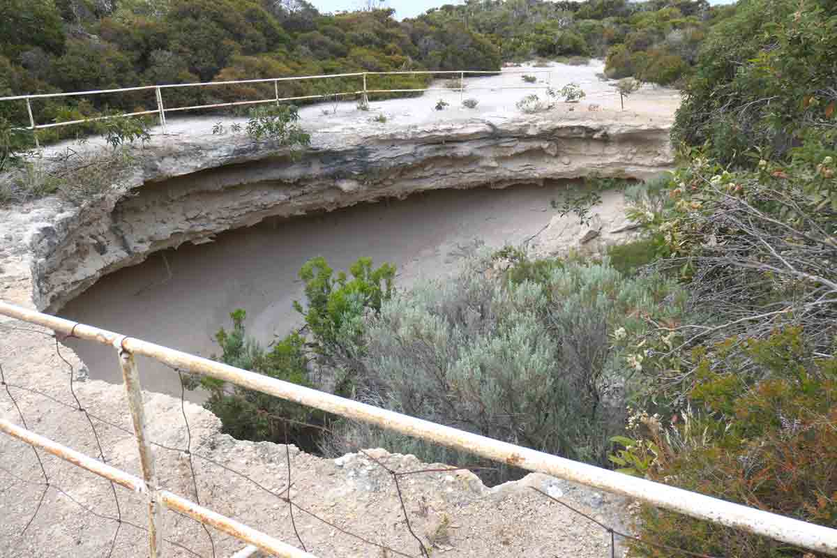
Theasktones Crevasse
This is one of the more unique crevasses at Whaler’s Way Sanctuary because it’s so thin, linear and neat compared to the others. According to the Whaler’s Way brochure, it’s apparently 13 metres deep and has 9-metre high walls.
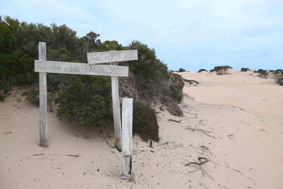
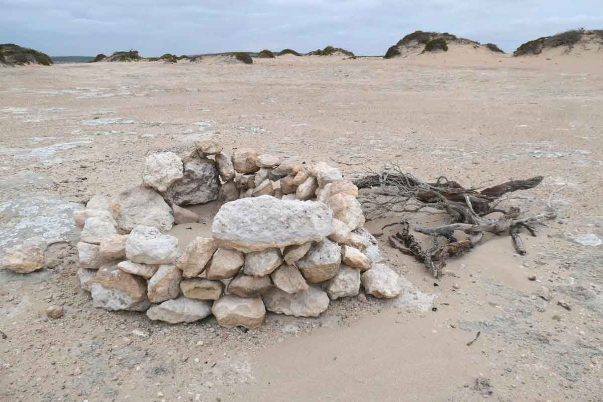
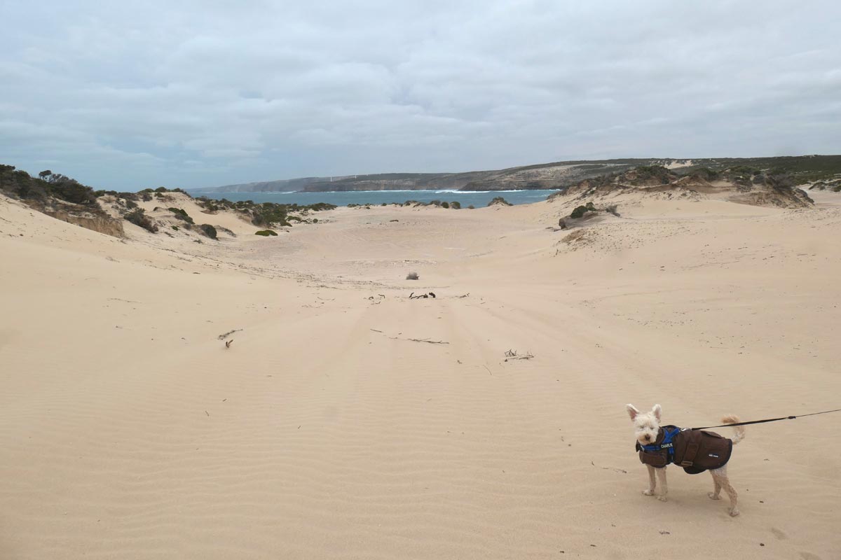
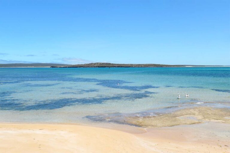
Red Banks
The road to Red Banks is recommended only for 4WD, and we can attest to that! It was rough, especially the closer we got. We were seriously head bopping.
Once you reach the end, there’s some large clear spaces and I’m guessing this is where people camp. There’s a large clearing that’s further from the edge and seemed a bit more protected from the wind. We came across a fire pit created with collected rocks.
From the cliff edge, you get spectacular coastal scenery and you can view out towards the wind farm. I would still be wary of crumbling edges though and getting too close.
We saw a sign that said “walk to beach 800 metres”, we walked along a sand dune up but I couldn’t really see a way down. Although, my hubby said he might have seen a ladder.
On the Whaler’s Way brochure, it says, “A beautiful beach surrounded by metamorphic headlands and inlets. Good swimming and exploring can be done at this beach”. So, there must be a way!
This was our last attraction for the day, and we were just too cold and over it by this point to really explore and look further.
Fauna and flora at Whaler’s Way Sanctuary
We didn’t see any wildlife during our time there, but according to the Whaler’s Way brochure, you might be able to spot kangaroos, emus, dolphins, fur seals and a variety of bird life.
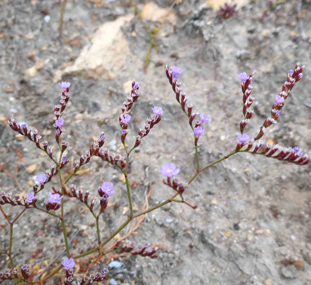
There’s an abundance of coastal vegetation, apparently several types of orchid, fringe lily, dwarf native pine and small rare wattle.
Facilities within Whaler’s Way Sanctuary
We stopped at their “barbecue area” to eat lunch, if you can call it that! It was a large concrete pad with a couple of weathered old metal and concrete benches on one end that looked like they had been there for the last 60 or so years.
There was no shelter of any kind. We actually ate in our car because it was too windy and the picnic benches were kind of dodgy. I didn’t see any BBQ facilities or might have missed them.
We didn’t need the toilet while we were exploring all the sights, not that we saw some at any point?! Although, I’ve read blogs and reviews about Whaler’s Way mentioning drop toilets within or just outside of the sanctuary. Not really mentioning specifically where they are.
Moral of the story, be prepared to rough it, this ain’t no government national park.
If you’re planning to camp overnight, you will need to be self-contained and bring everything you need. There’s no running water, electricity or other facilities/services of any kind available at Whaler’s Way Sanctuary.
Preparing for your visit to Whaler’s Way Sanctuary
If you’re planning or considering a visit to Whaler’s Way, here are some things to keep in mind:
- The unsealed roads and “car parks” are crap, don’t do this if you’ve got low clearance!
- Purchase your entry permit before you head off.
- Print or save a copy on your phone of the Whaler’s Way Sanctuary brochure, which has a mud map of the area (PDF).
- Check the weather for the day; you want to avoid extremely windy and/or wet conditions.
- Wear good footwear for walking along rocky and uneven surfaces.
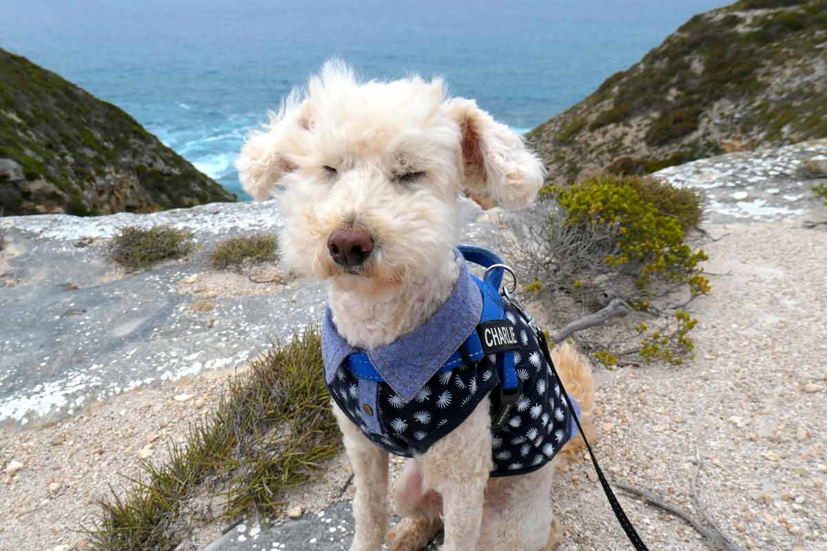
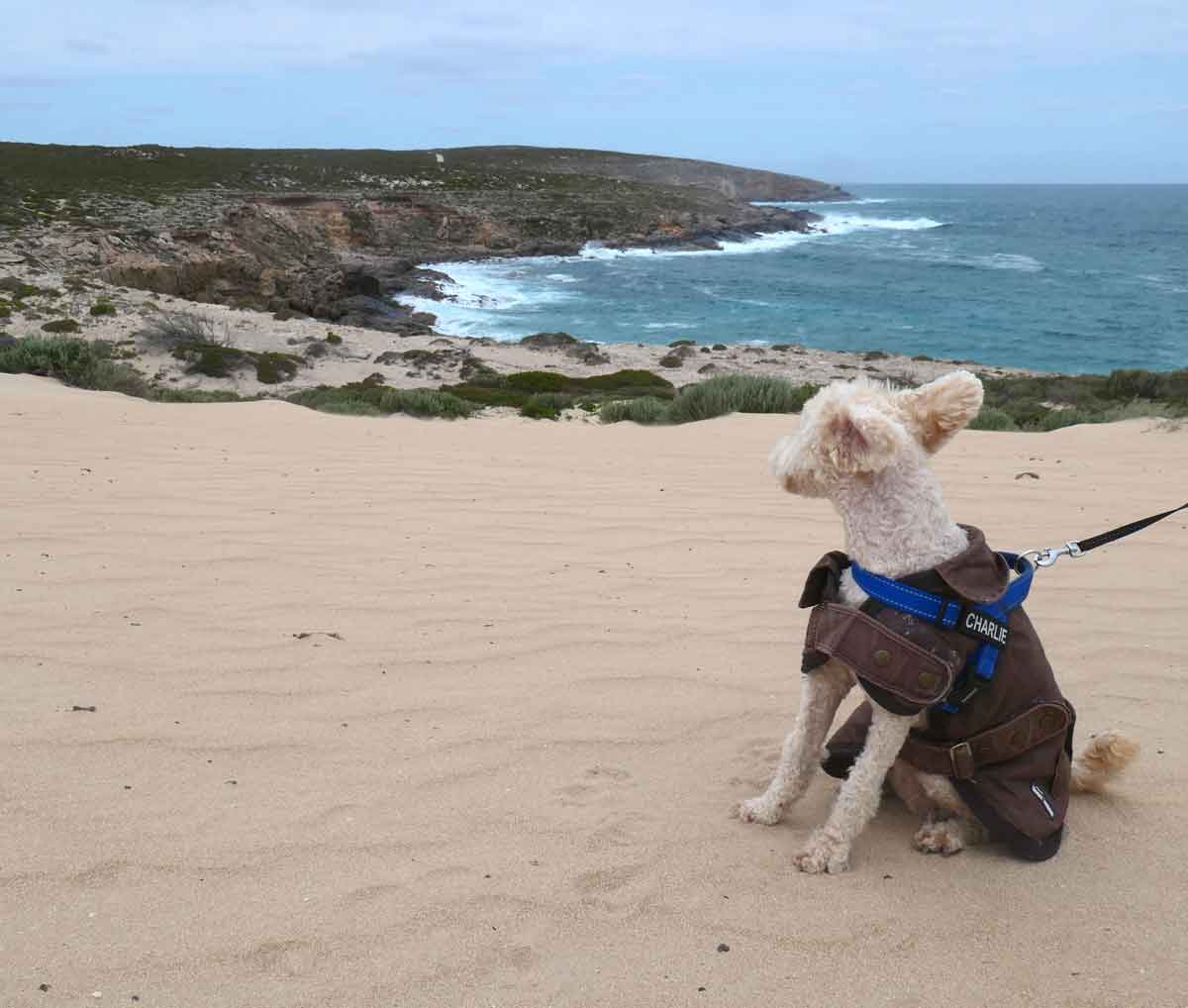
- Bring appropriate clothing for the weather; it can get cold and windy along the coast. Charlie had to have an outfit change from a shirt to a thicker jacket when we went!
- Don’t forget sun protection and insect repellant if it’s a hot and still day.
- BYO water & food for yourself and your doggy.
- Be mindful of limited mobile or internet service.
And that’s a wrap!
I hope you’ve enjoyed exploring Whaler’s Way Sanctuary through this journal entry. Despite its flaws, I still think it was a memorable experience because of the stunning ruggedness of this southern section of the Eyre Peninsula coastline.
Plus, if you’re travelling with your precious furbaby, it’s dog-friendly, which is always a plus!
Have you been to any of these places before? Please feel free to share your experiences in the comments or pop in any questions you might have; I’d love to hear from you.
Safe travels and happy exploring! Thanks for joining me, hope to see you again!
Sheryl
Like this journal entry? Save it on Pinterest
Other Eyre Peninsula entries

Hey Pawrents,
Planning your dog-friendly Aussie Adventure?
Check out my interactive map full of amazing dog-friendly breweries, cafes, restaurants, pubs, walking trails, beaches and more.